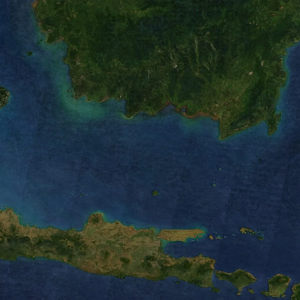
Cloudless satellite image
I found excellent Image-compositing scripts for filtering weather out of satellite images https://github.com/celoyd/wheather and decided to give a try.
This analysis based on MODIS subsets image from NASA - https://lance-modis.eosdis.nasa.gov. See below:
Located directly on the Equator and covered with mountains and rainforest, Indonesia is one of the cloudiest places on Earth. Getting cloud free image from MODIS is difficult
[caption id=“” align=“alignnone” width=“1024”]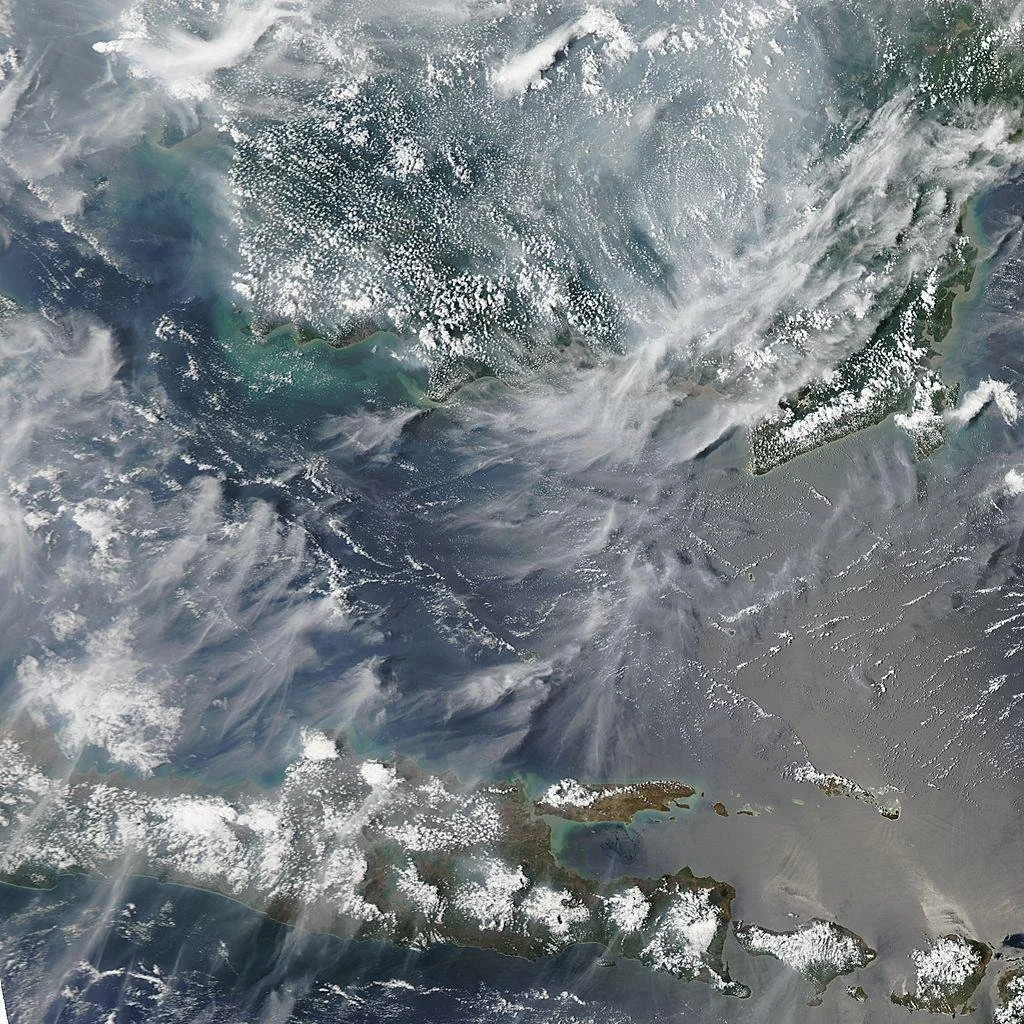 Sample quick look, 23 July 2012 [/caption]
Following the script, I downloaded the MODIS quick look. And you can see every day sometimes cloud-free and mostly not.
[caption id=“” align=“alignnone” width=“1024”]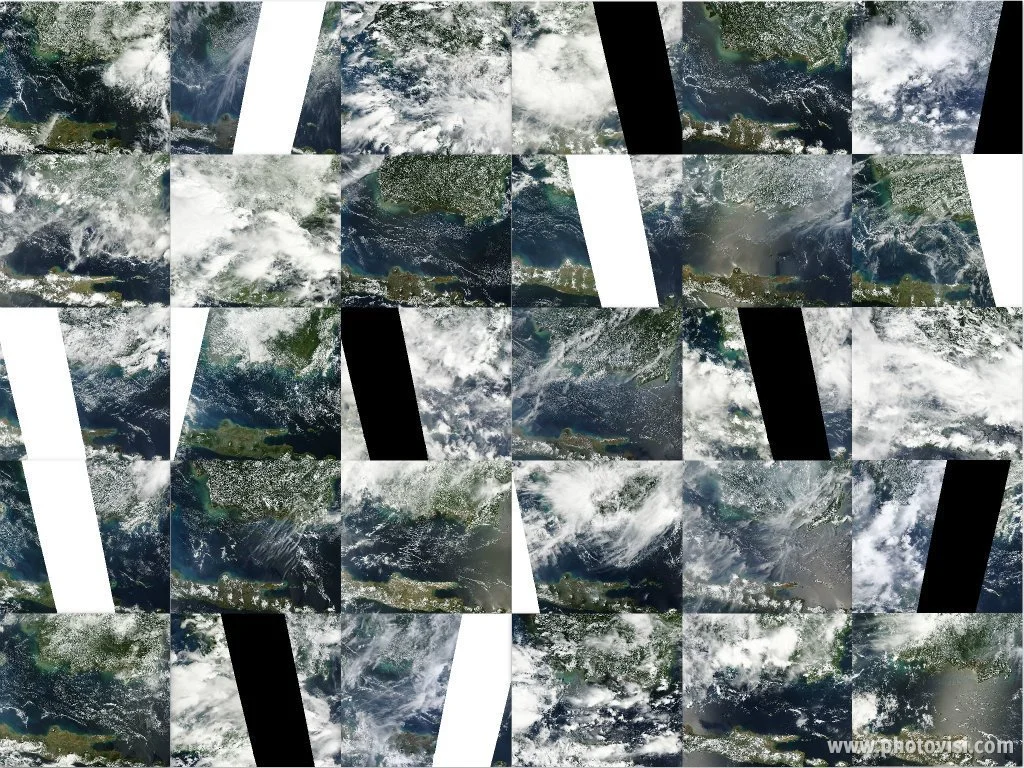 1 - 31 July 2012, 1km pix res [/caption]
If we could create an average image from all the collection in the previous picture, it will look as below picture.
[caption id=“” align=“alignnone” width=“1024”]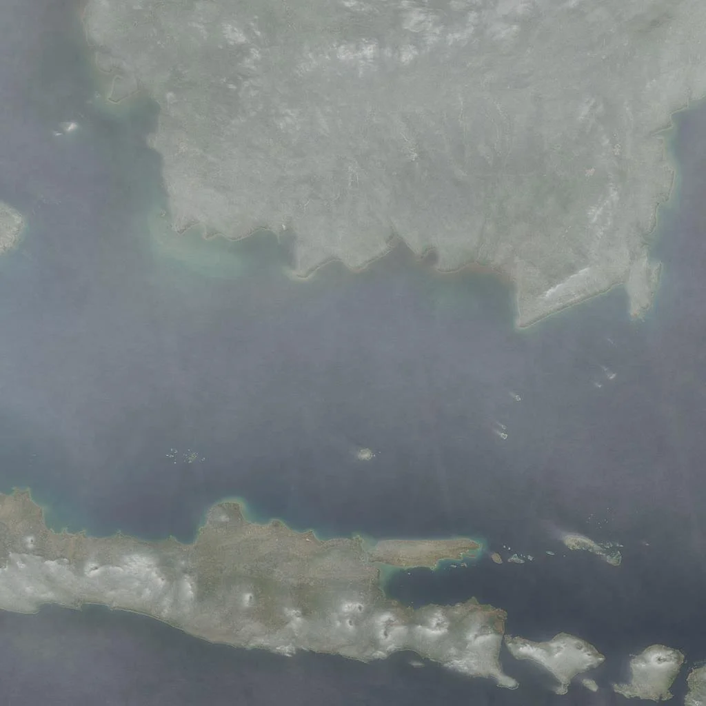 Simple average [/caption]
Then we can sort per pixel of all the image collection, and leave the least cloudy-looking layers and average the rest. Details are below:
- Split them into strips
- Sort the strips, pixelwise, to remove cloud cover
- Average the cloudless strips
- Rejoin the strips into a cloudless image.
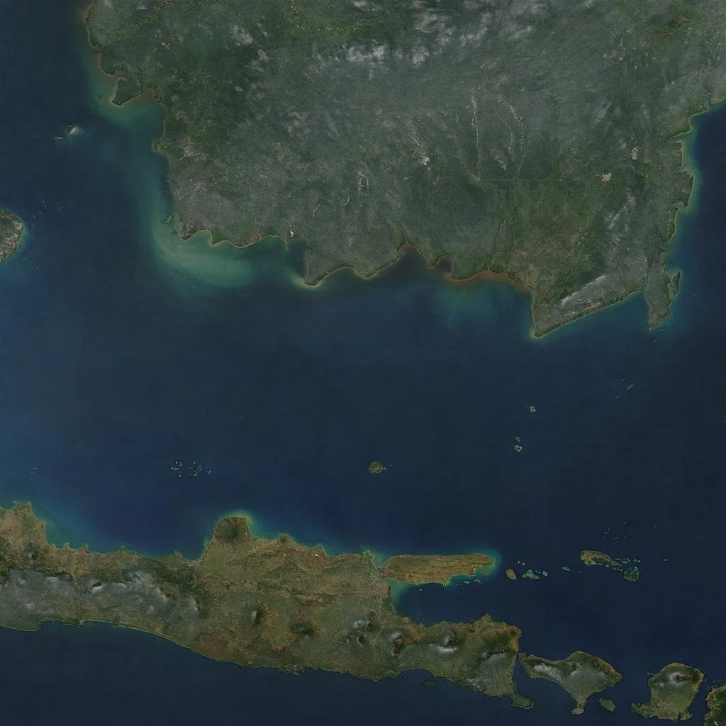
Finally choose the top of quality and we got below picture.