Maps & Infographics
Visual storytelling with geospatial data
I am having fun playing with geospatial and remote sensing data. Have a look at selected maps/infographics that I have ever made!
Tip
Click on any map to view it in full resolution in a new tab.
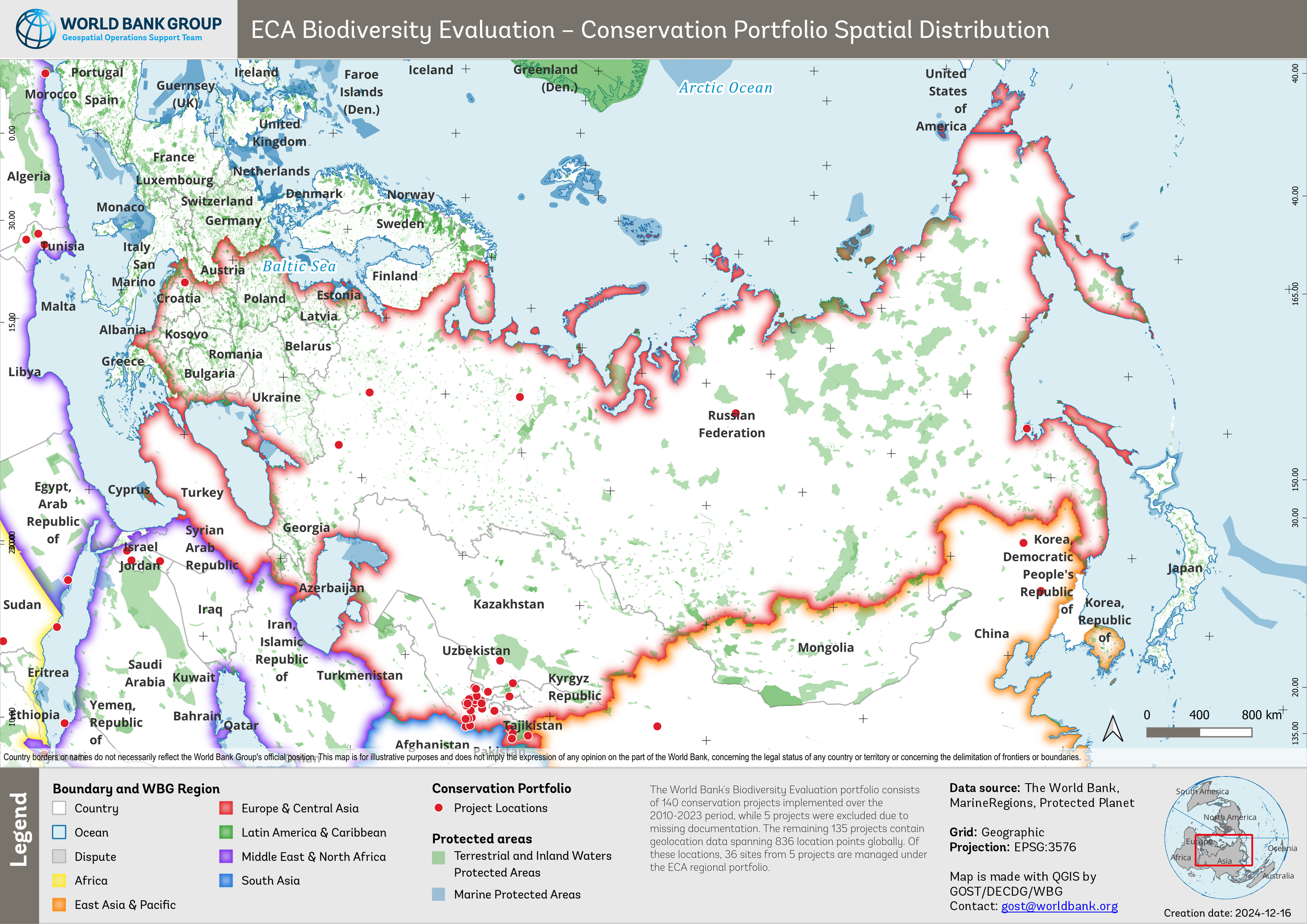
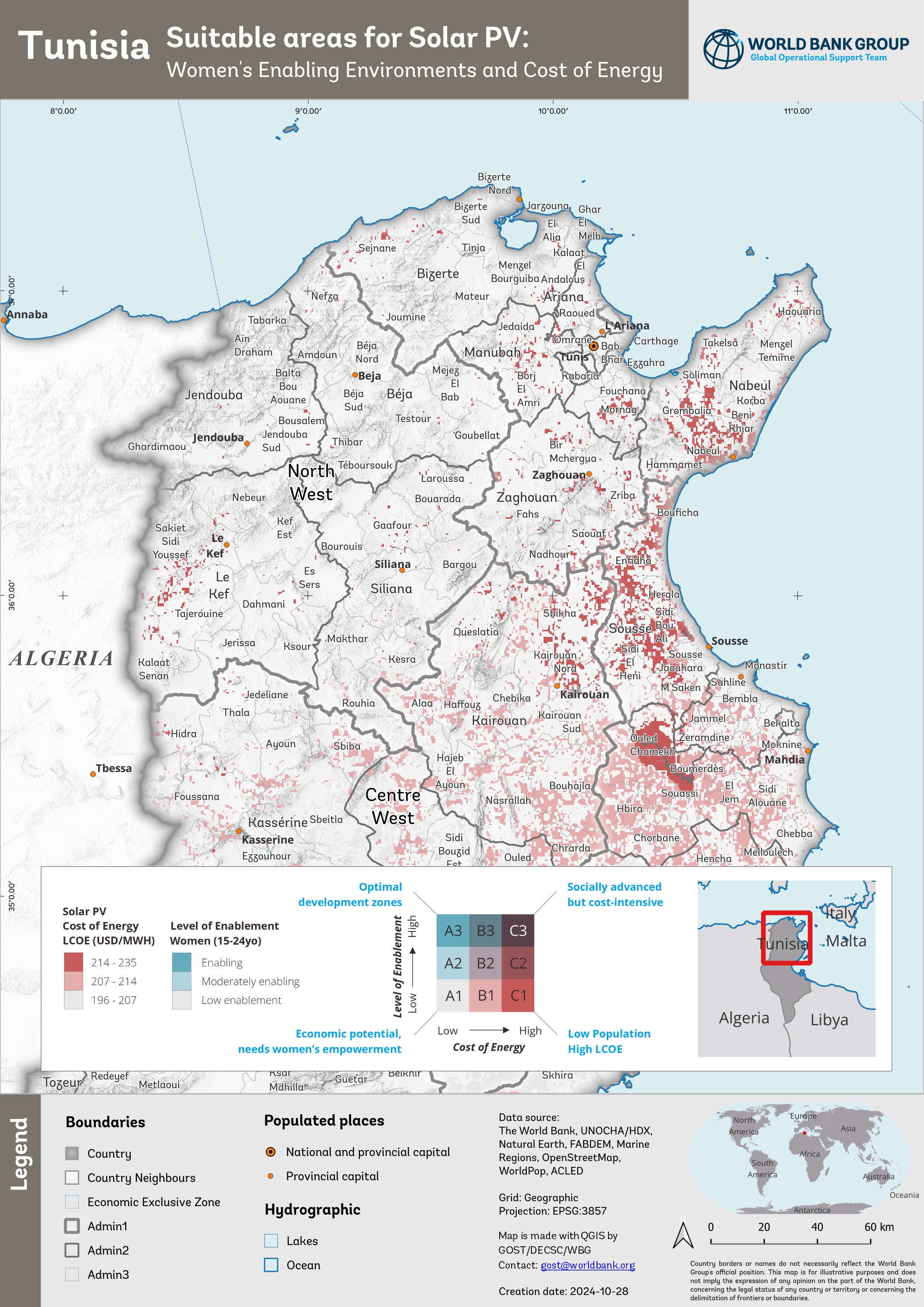
2024
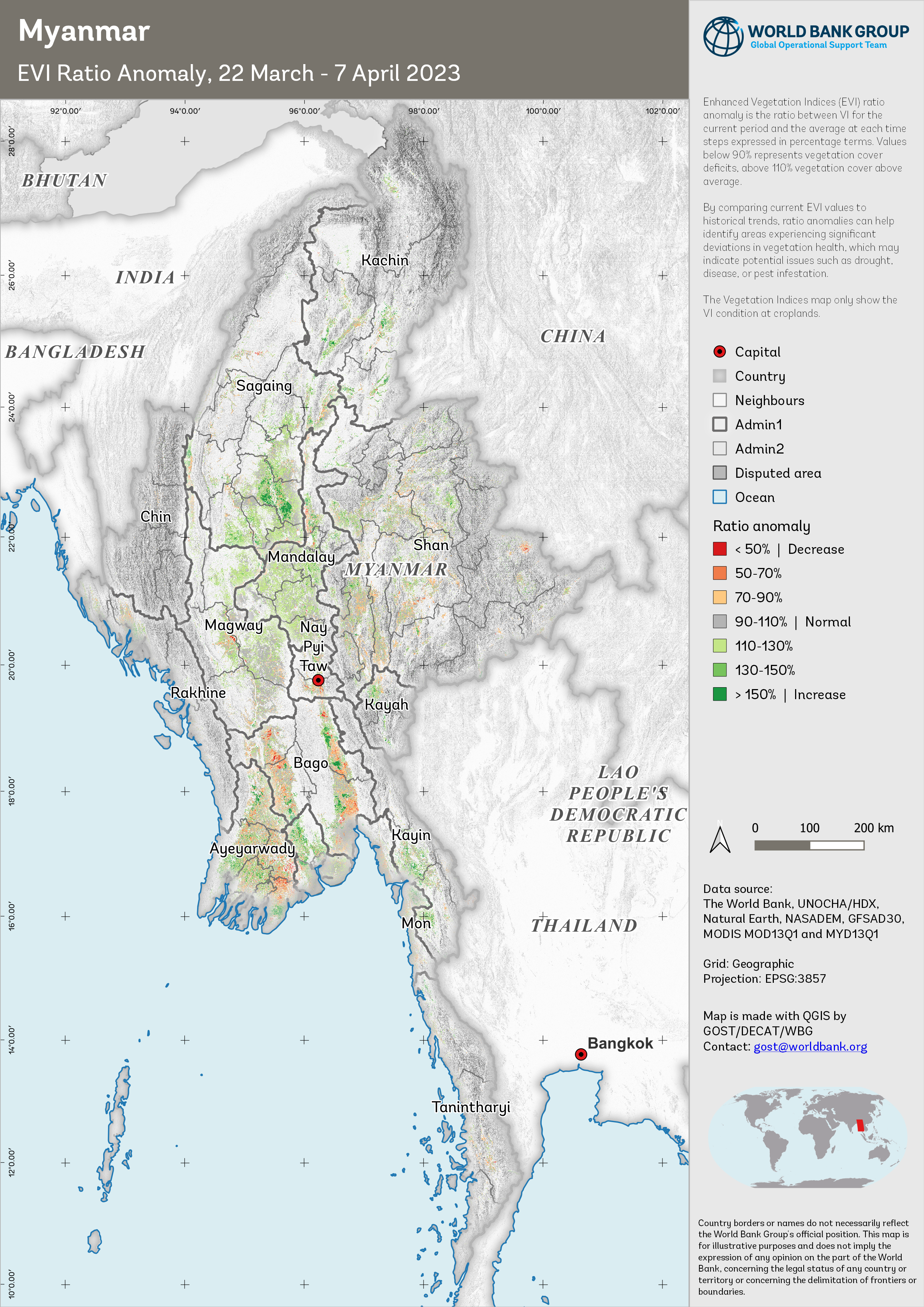
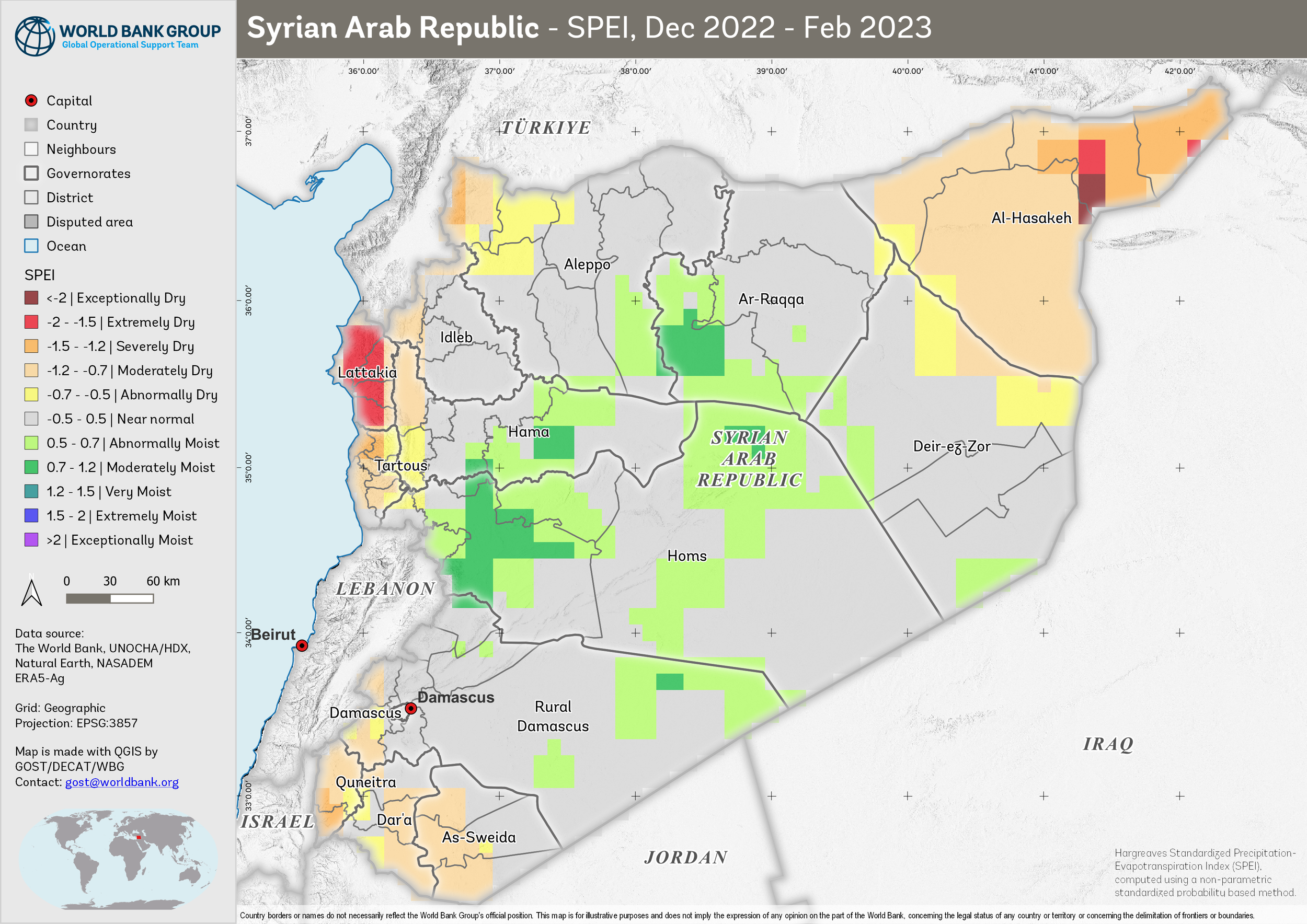
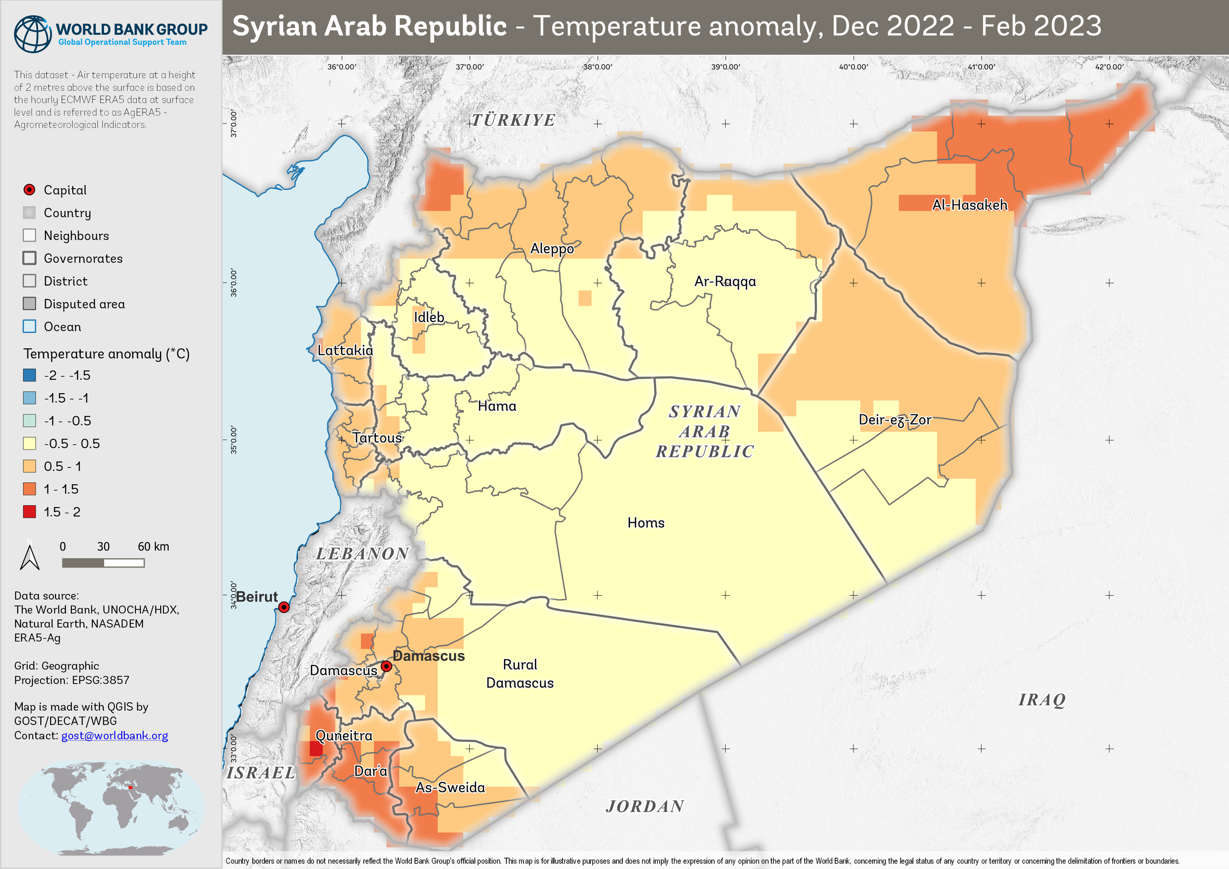
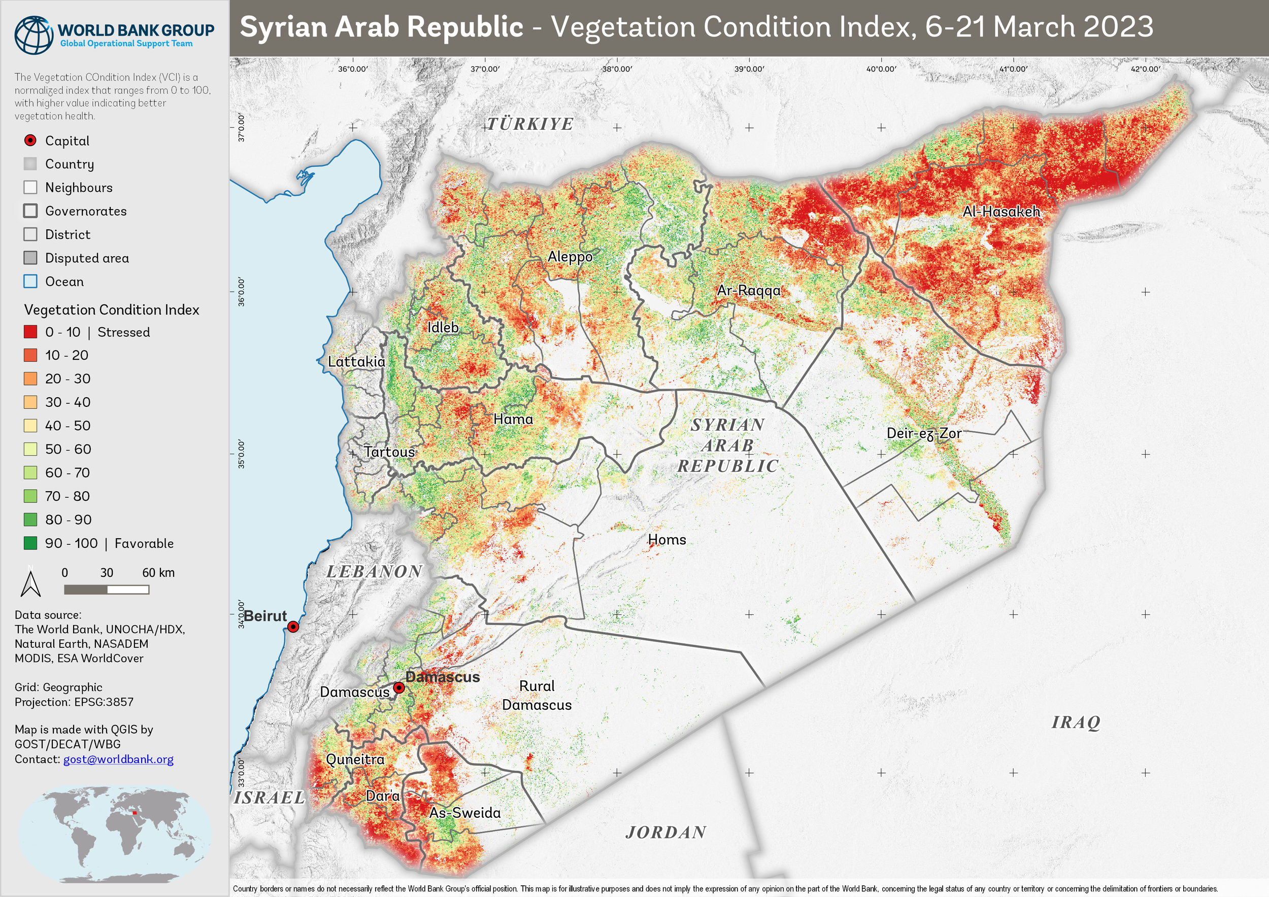
2023
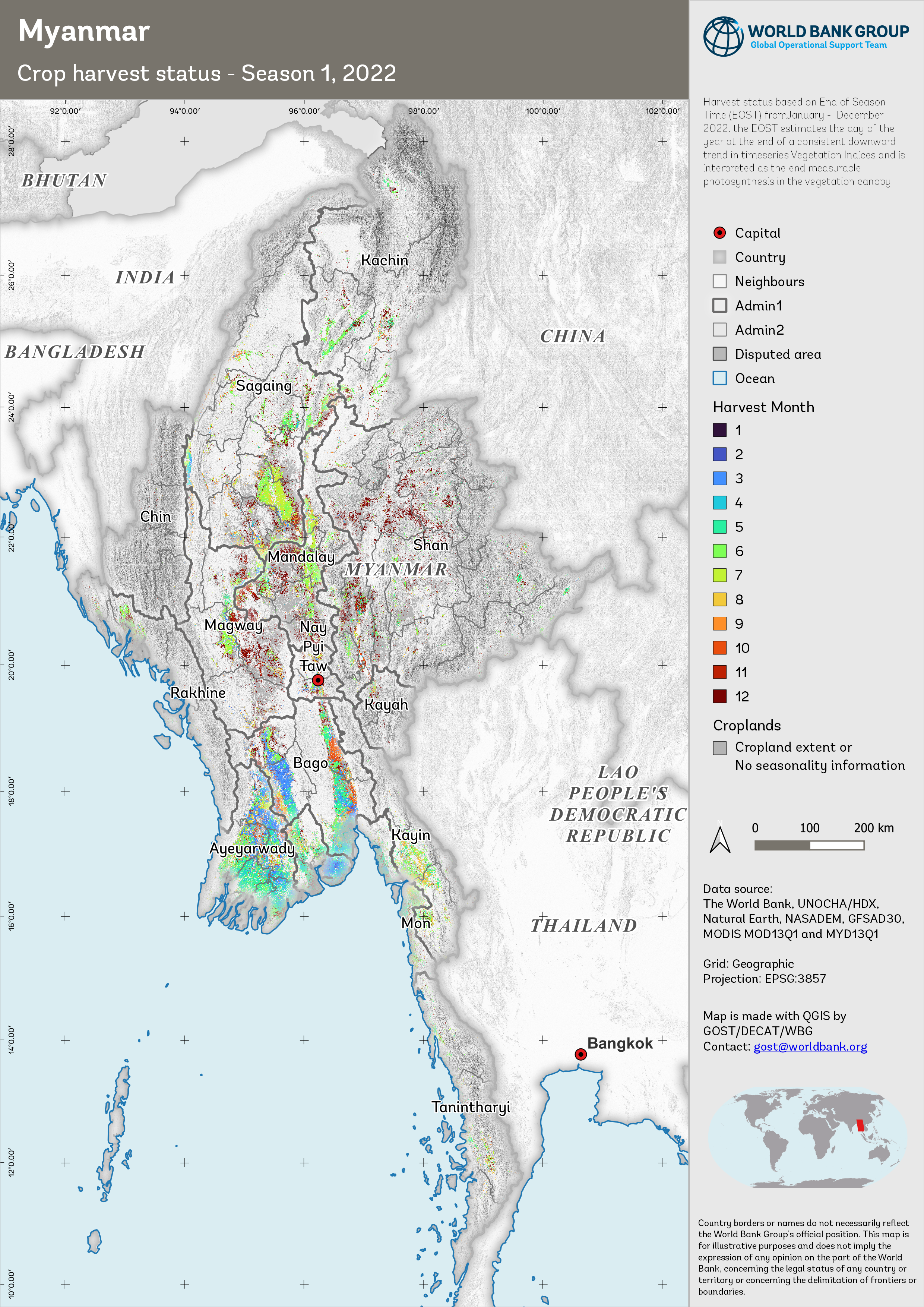
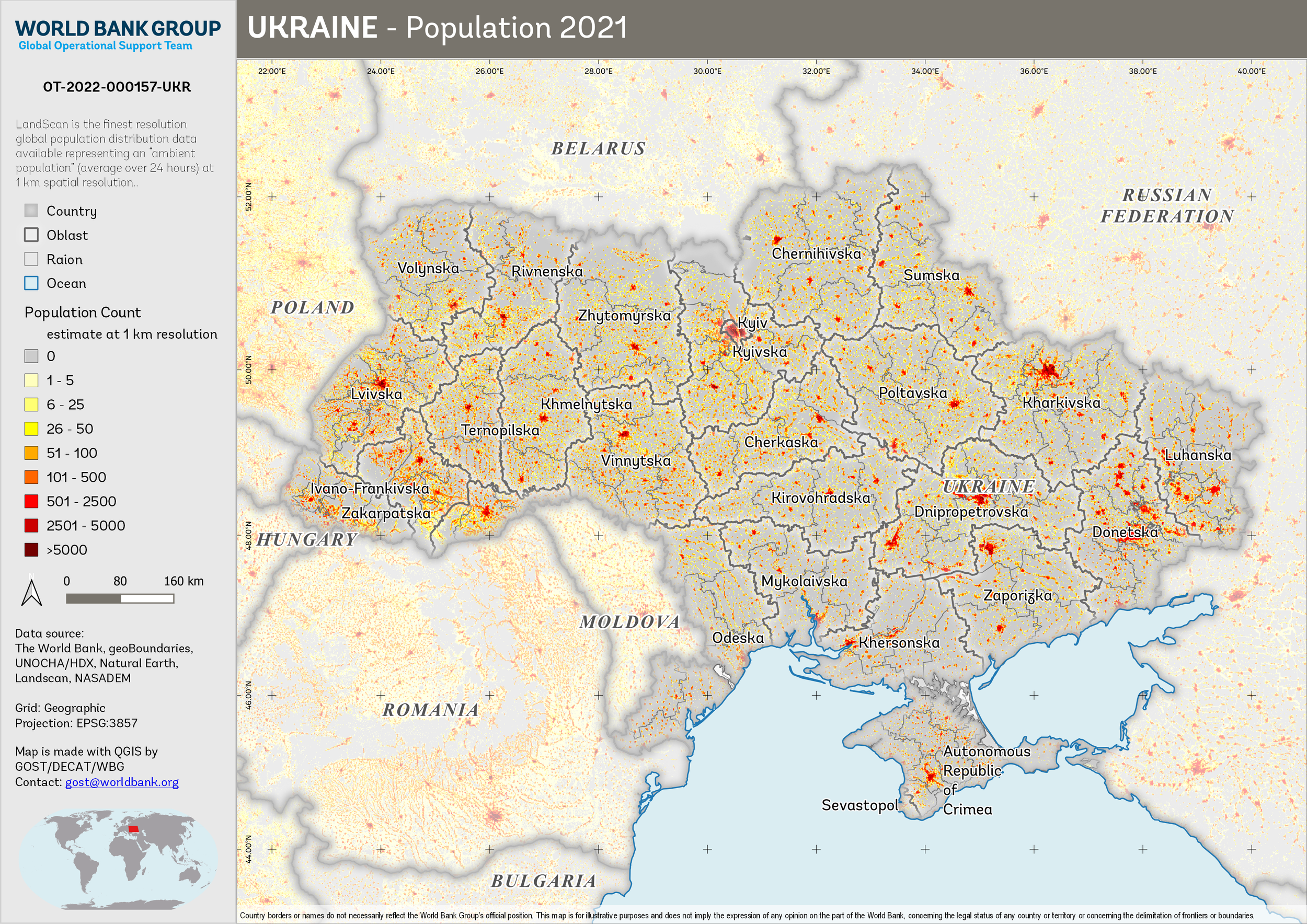
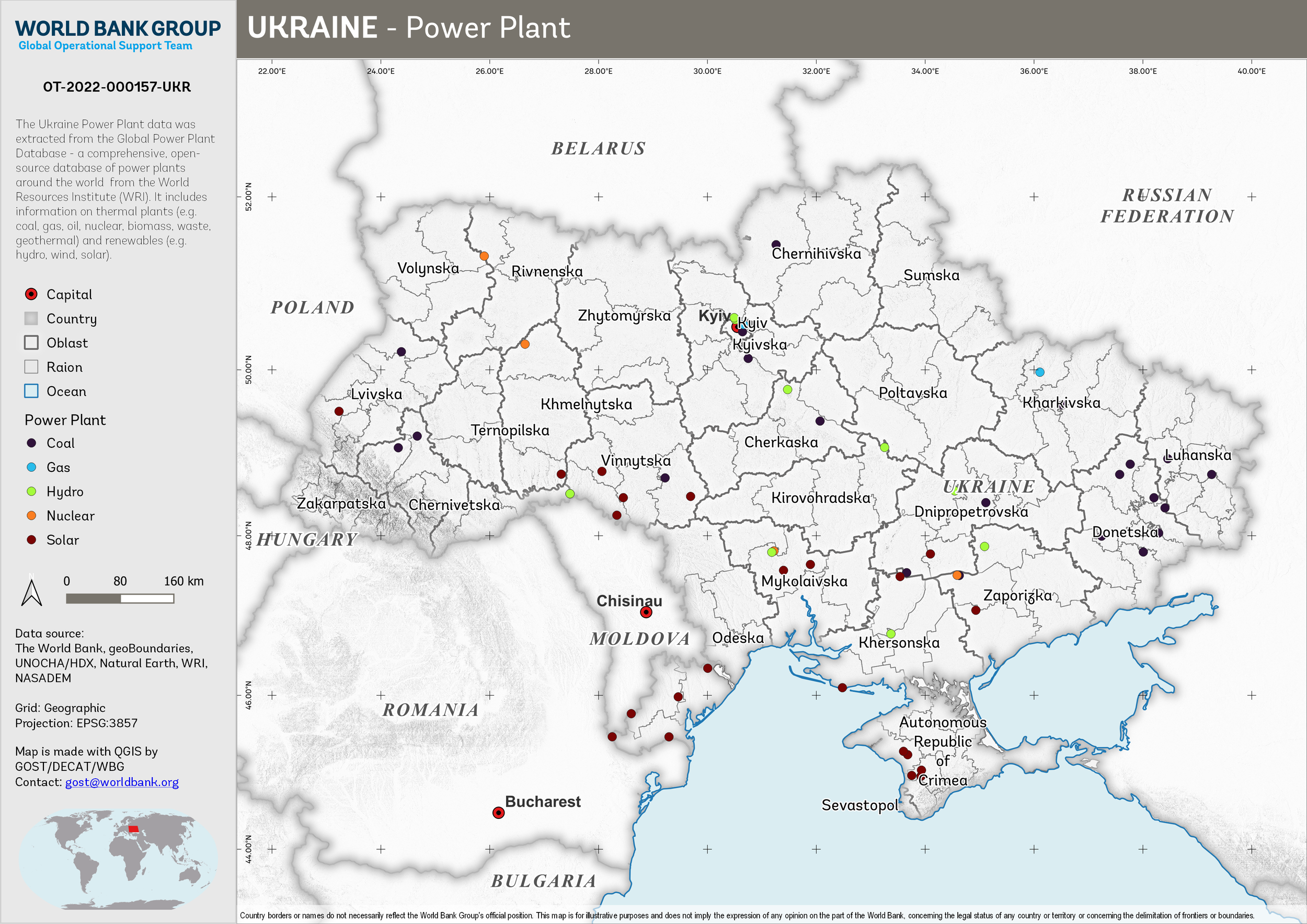
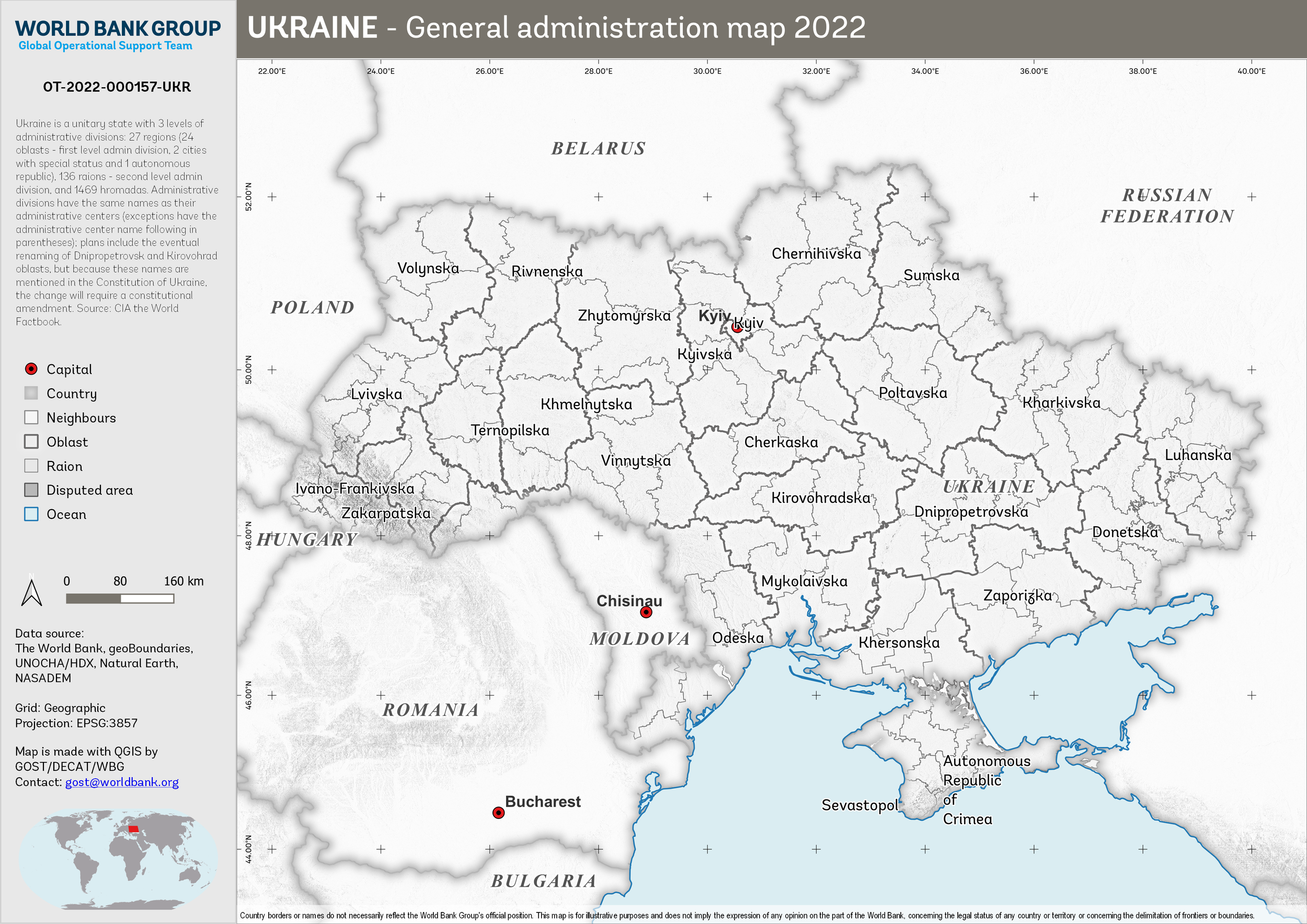
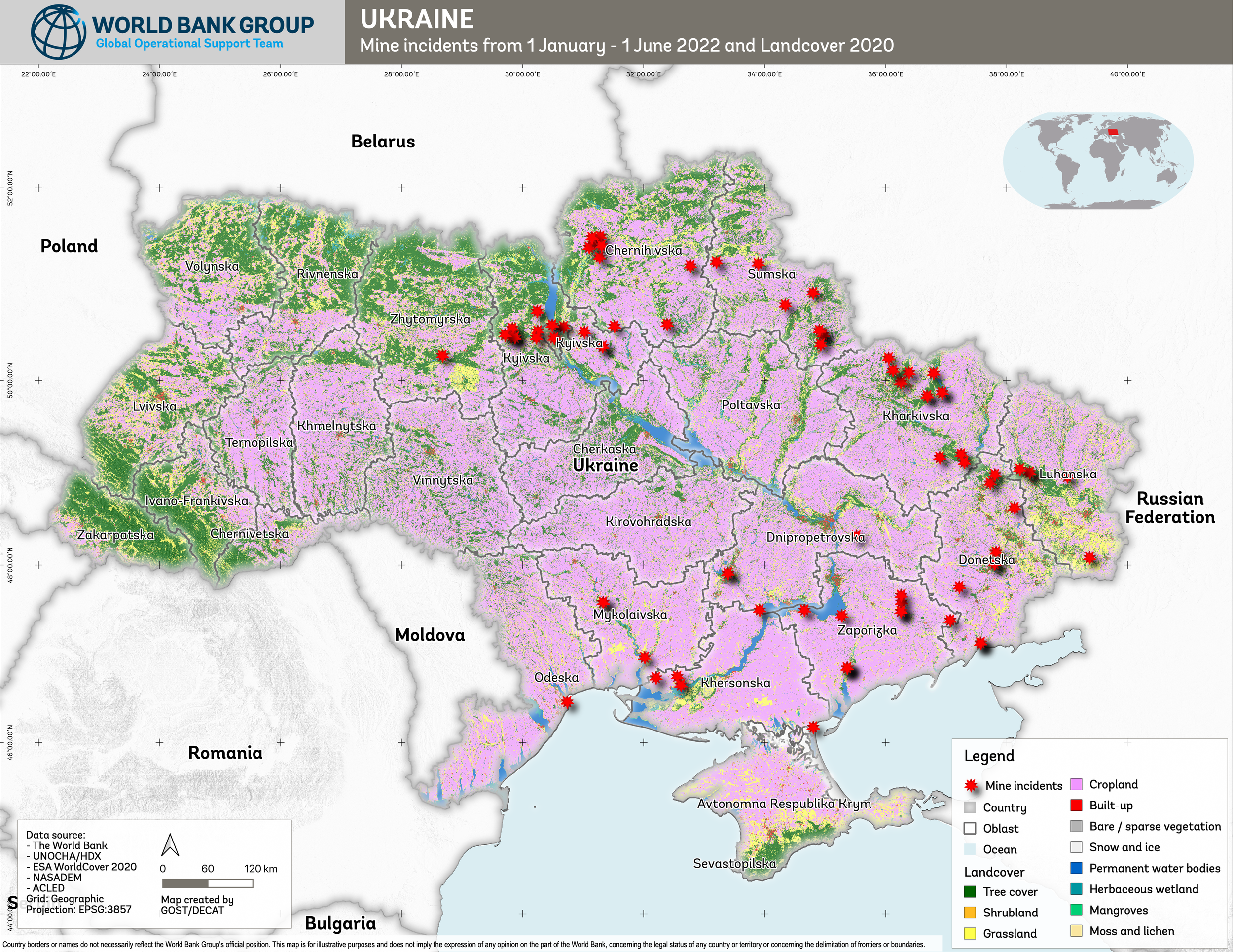
2022
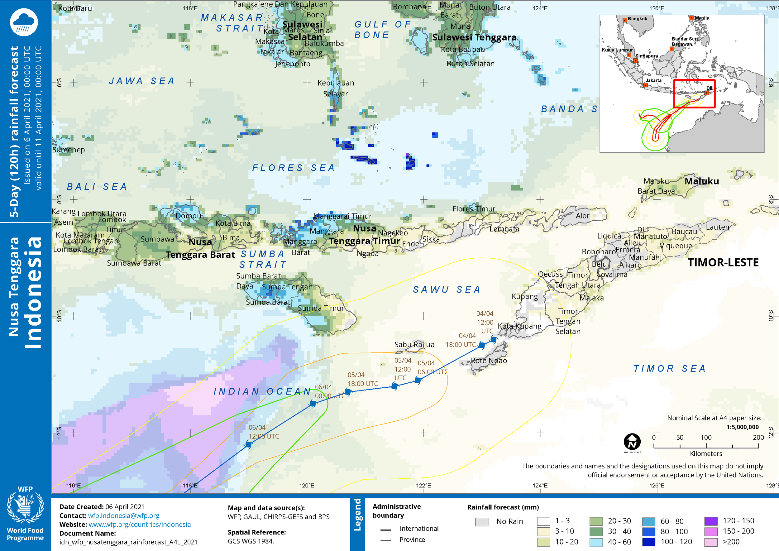
2021
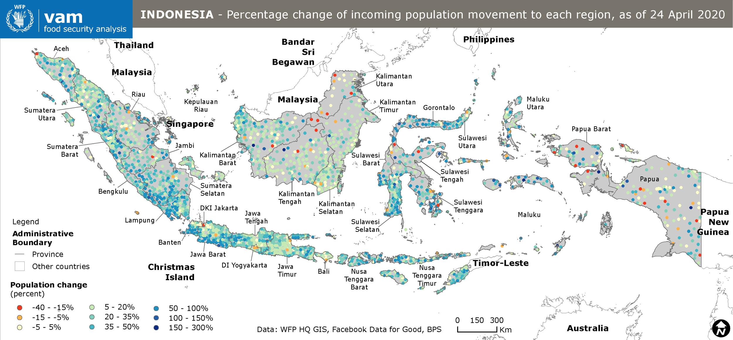
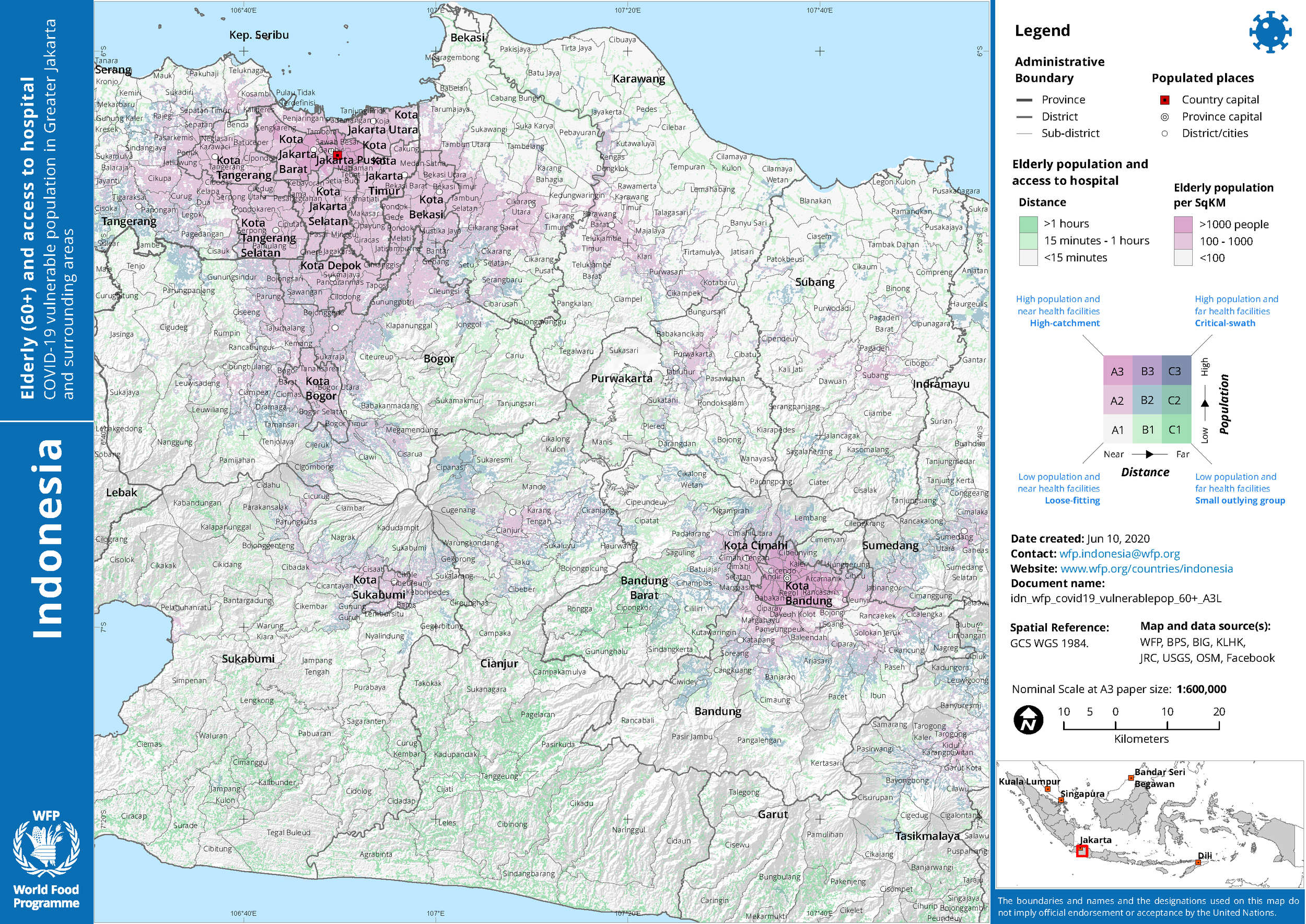
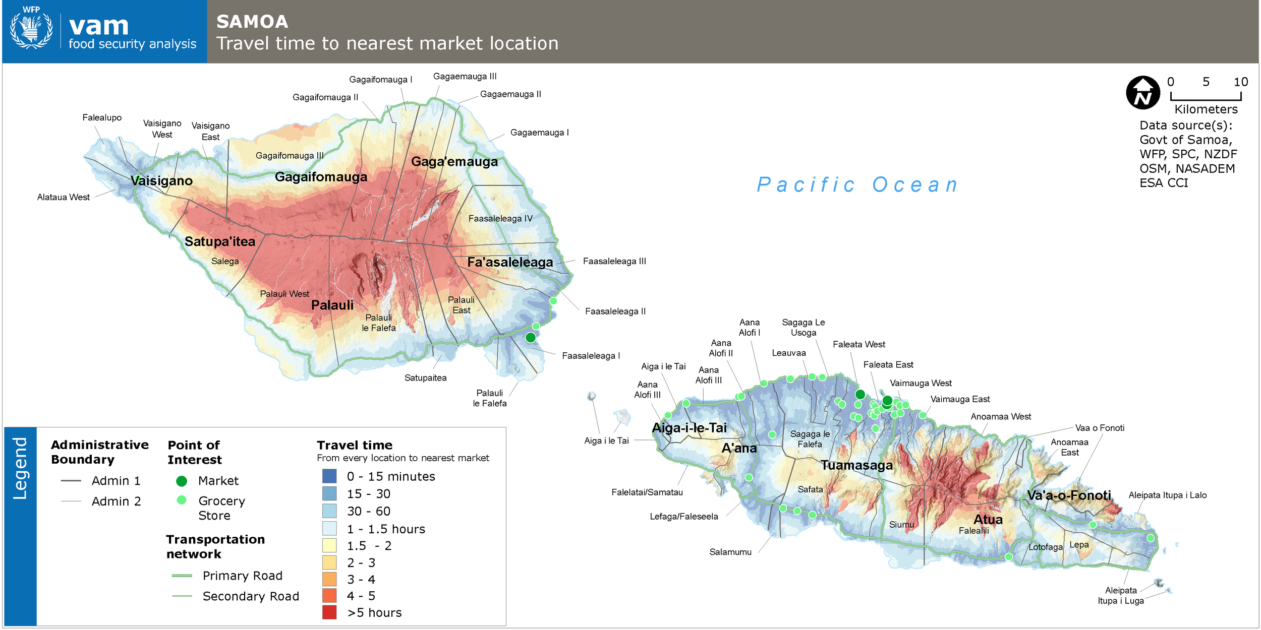
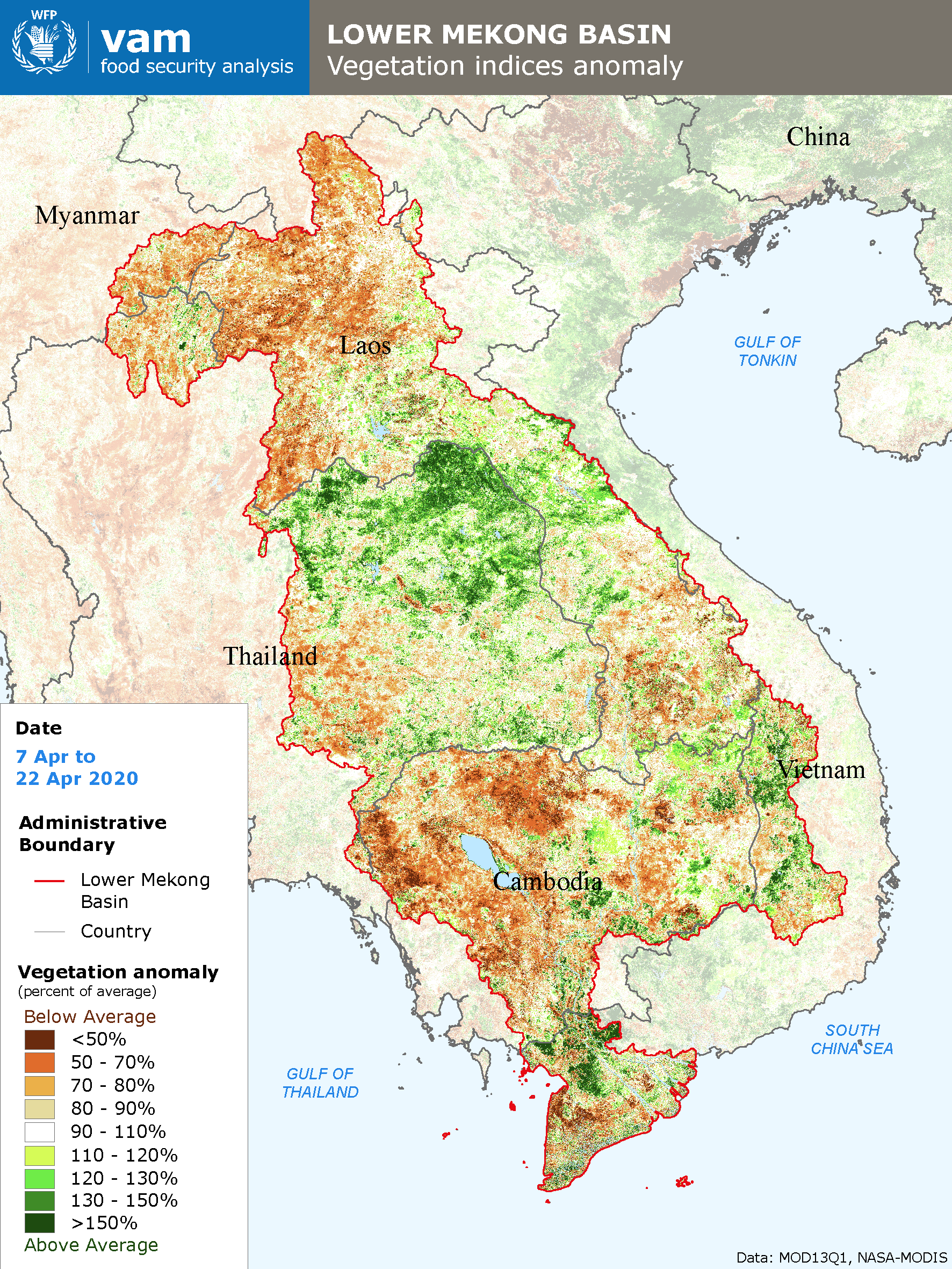
2020
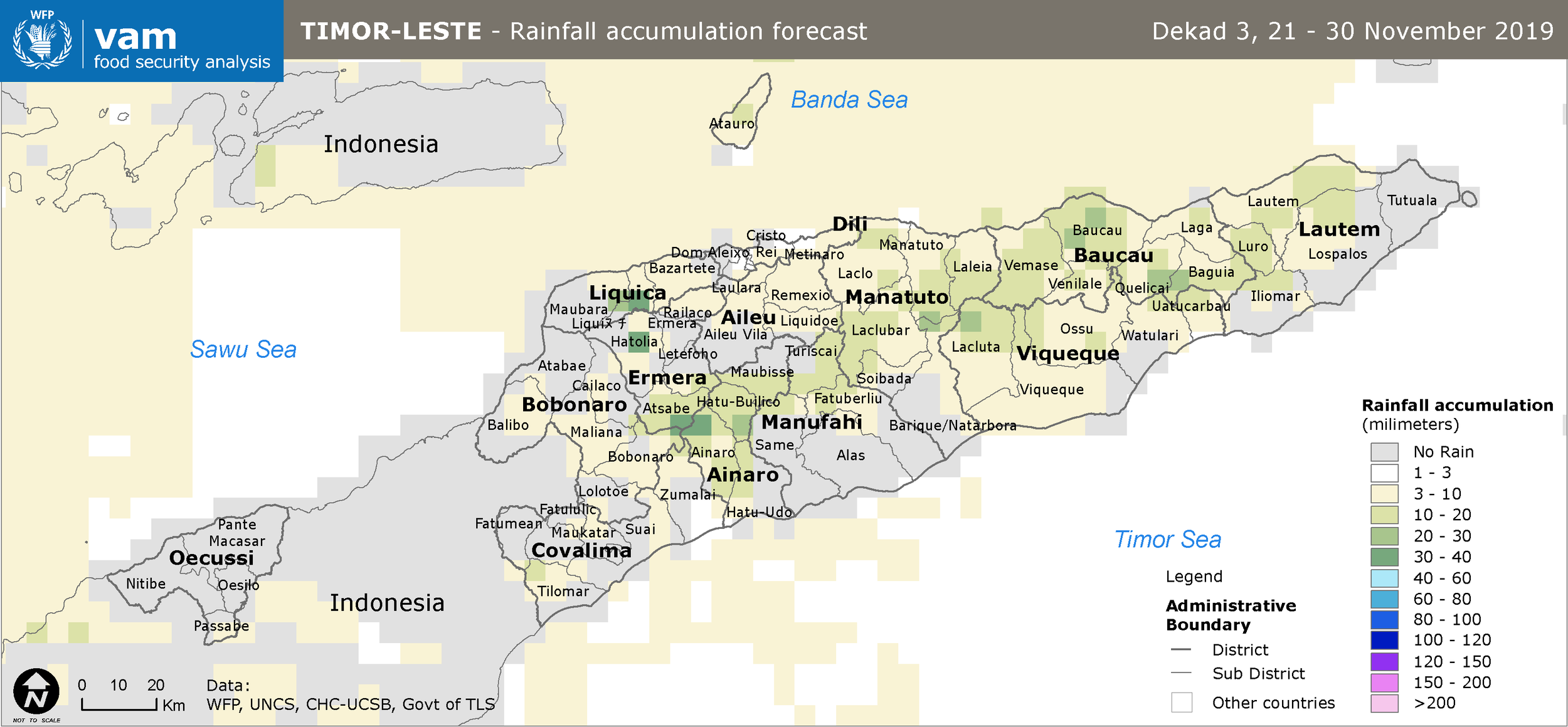
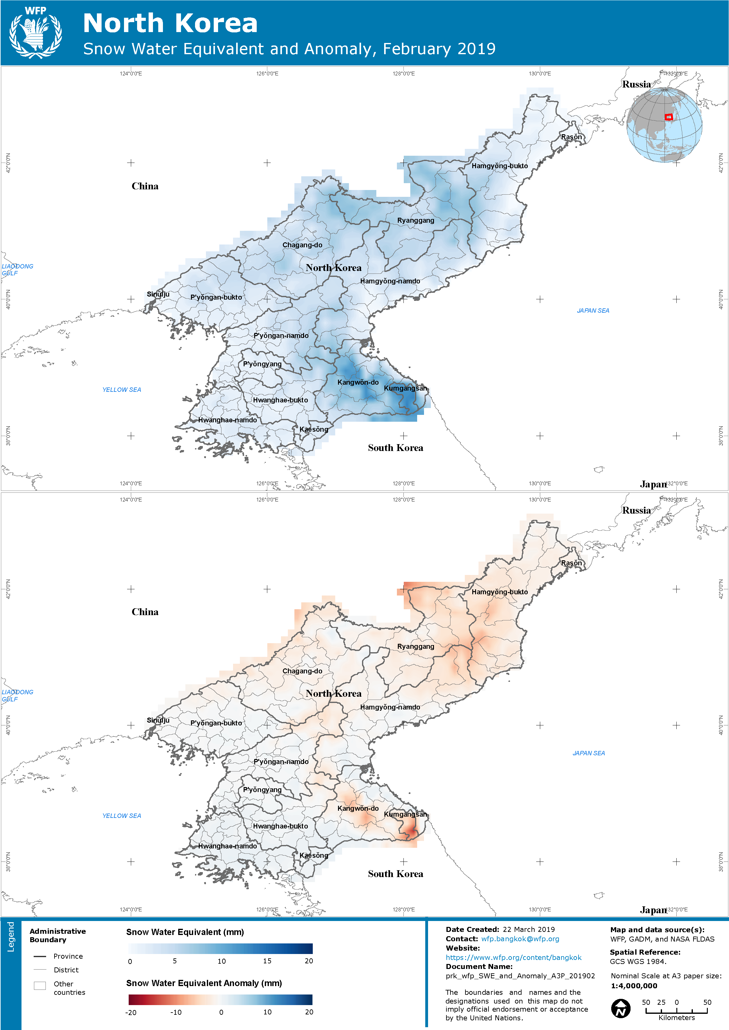
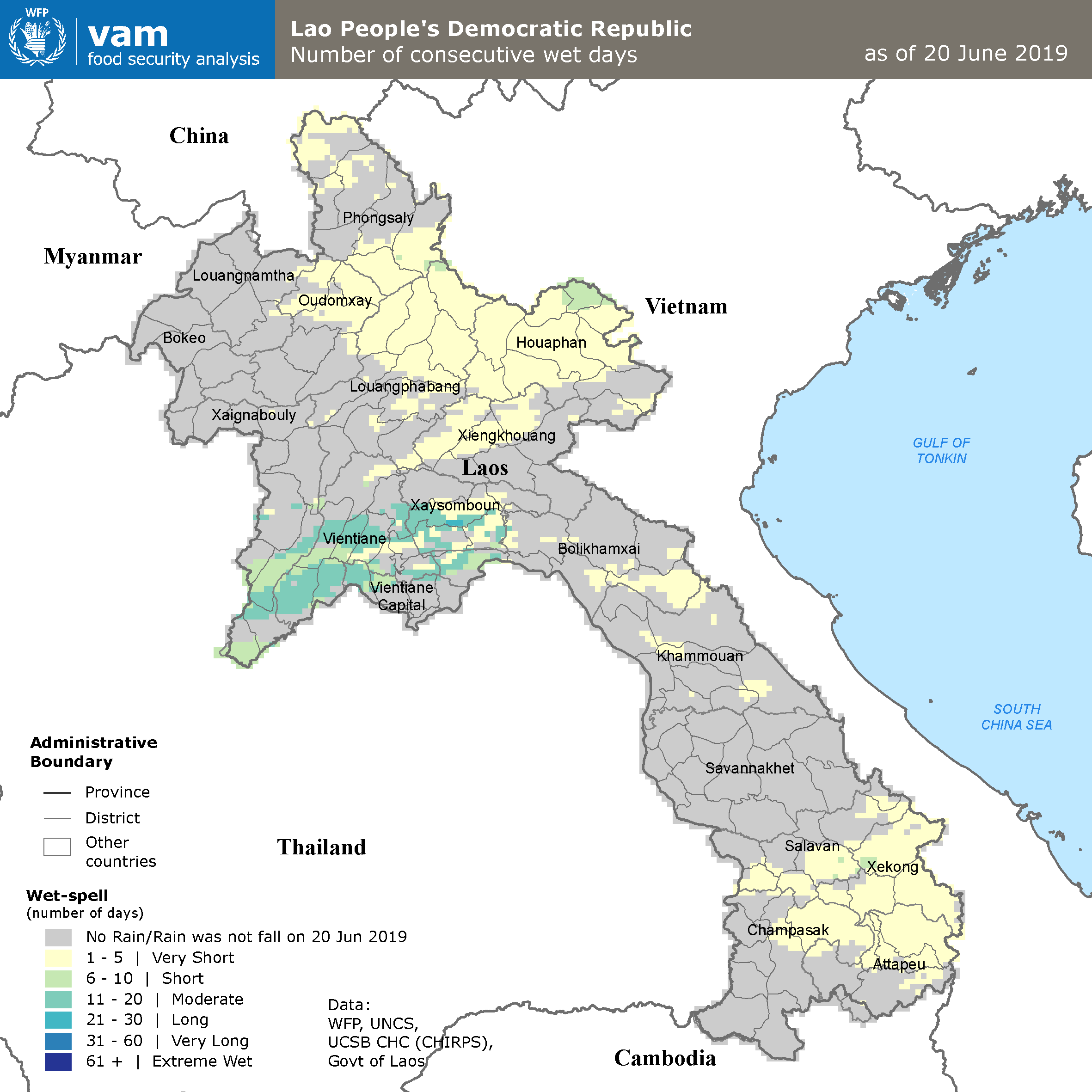
2019
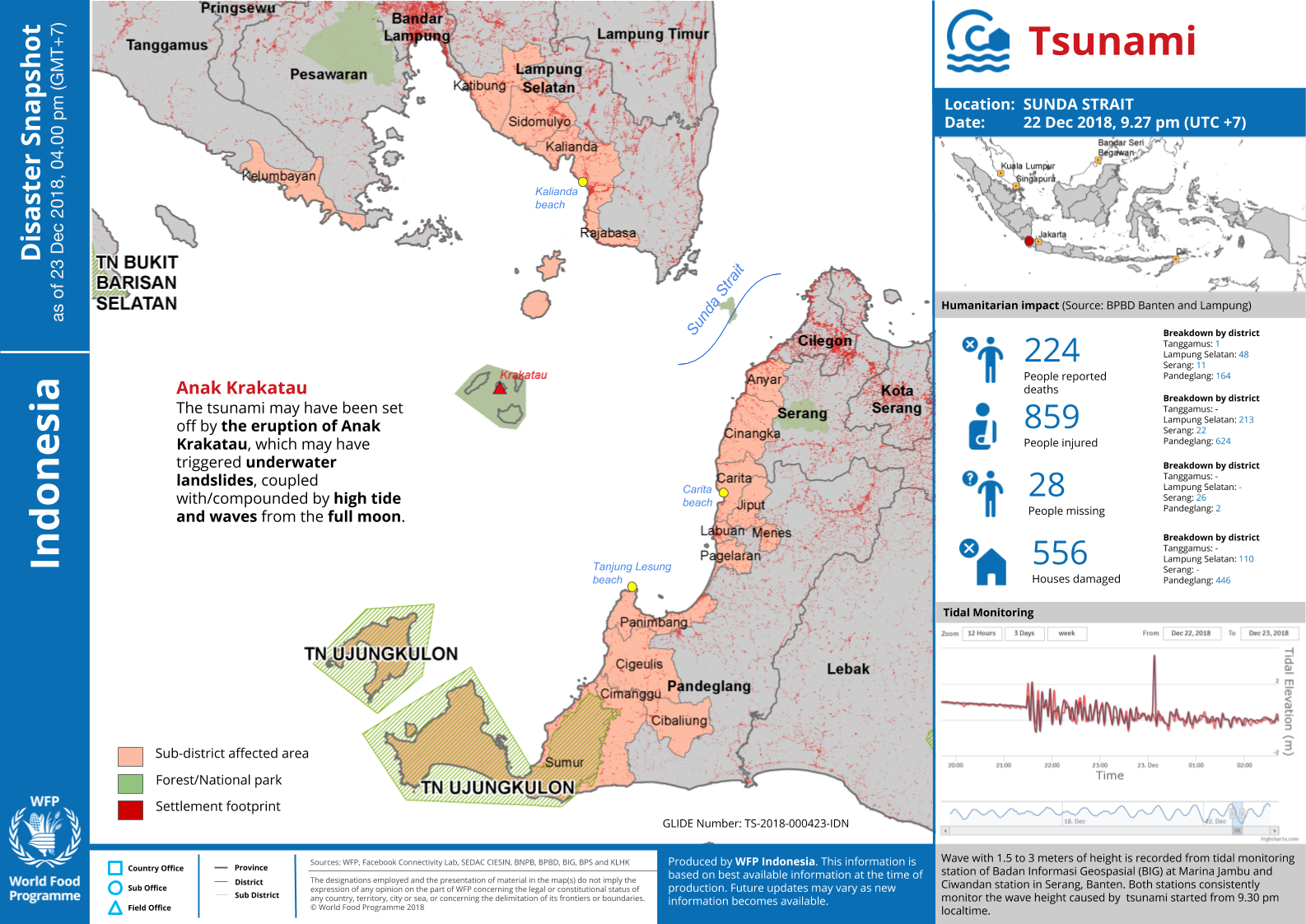
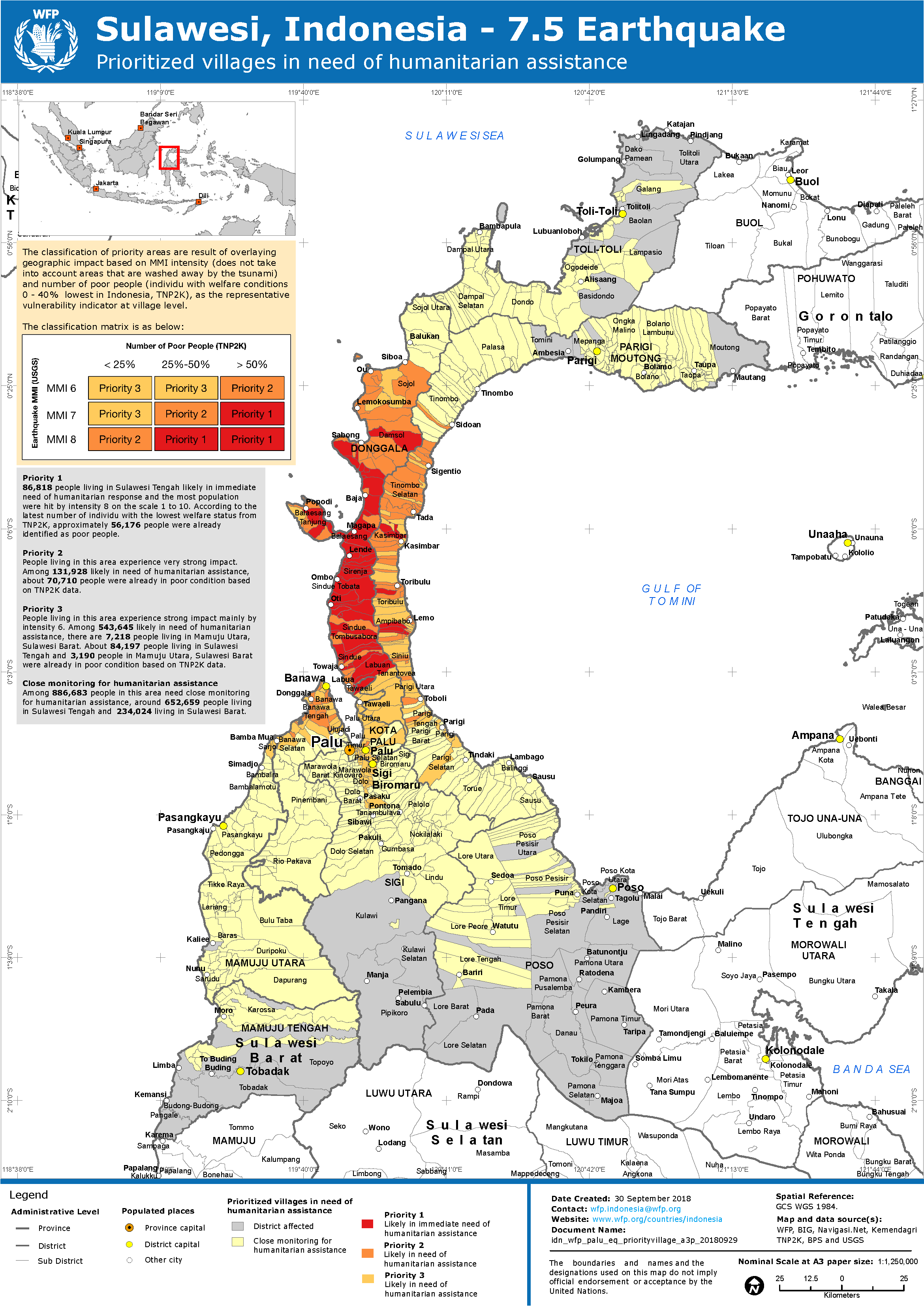
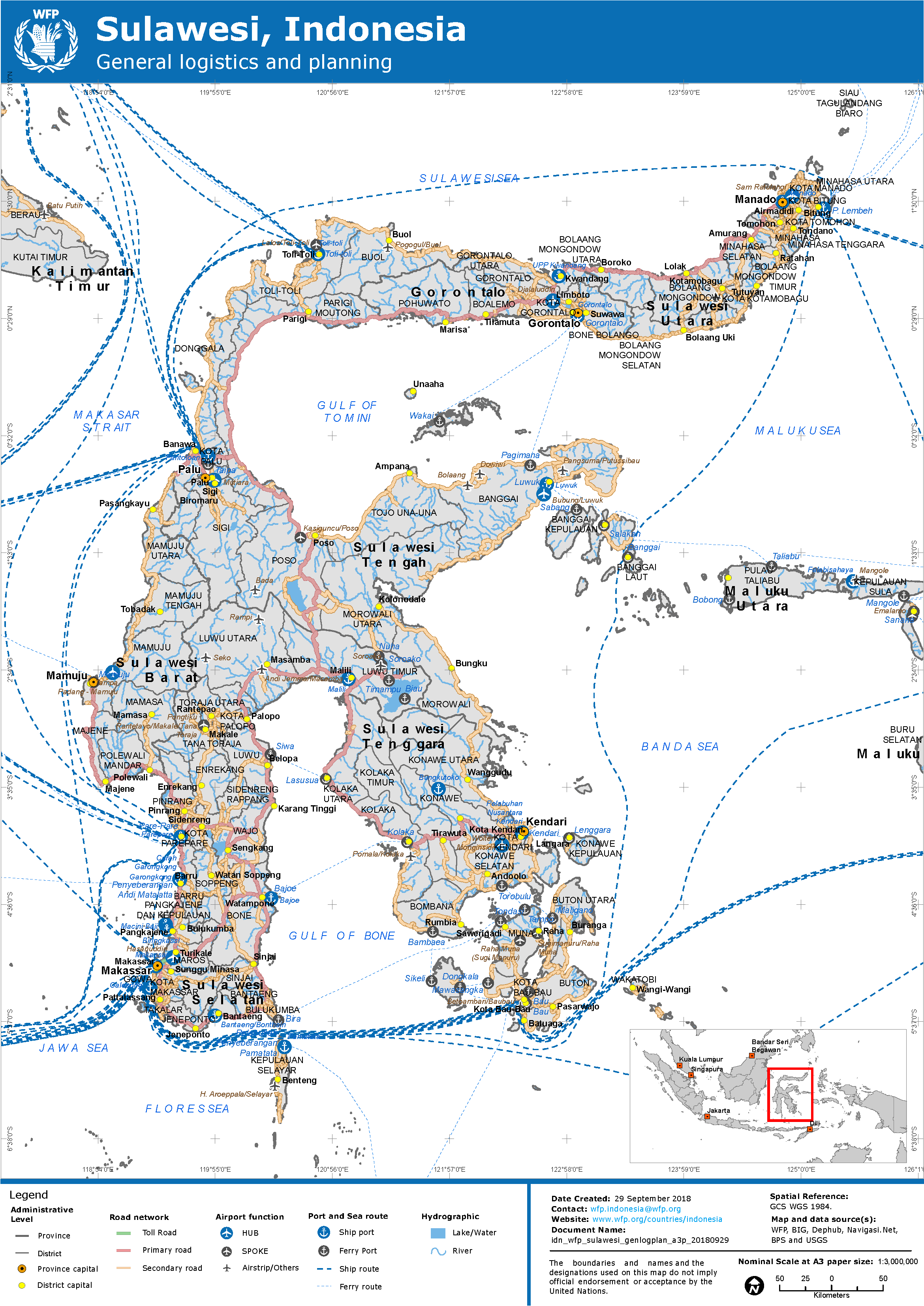
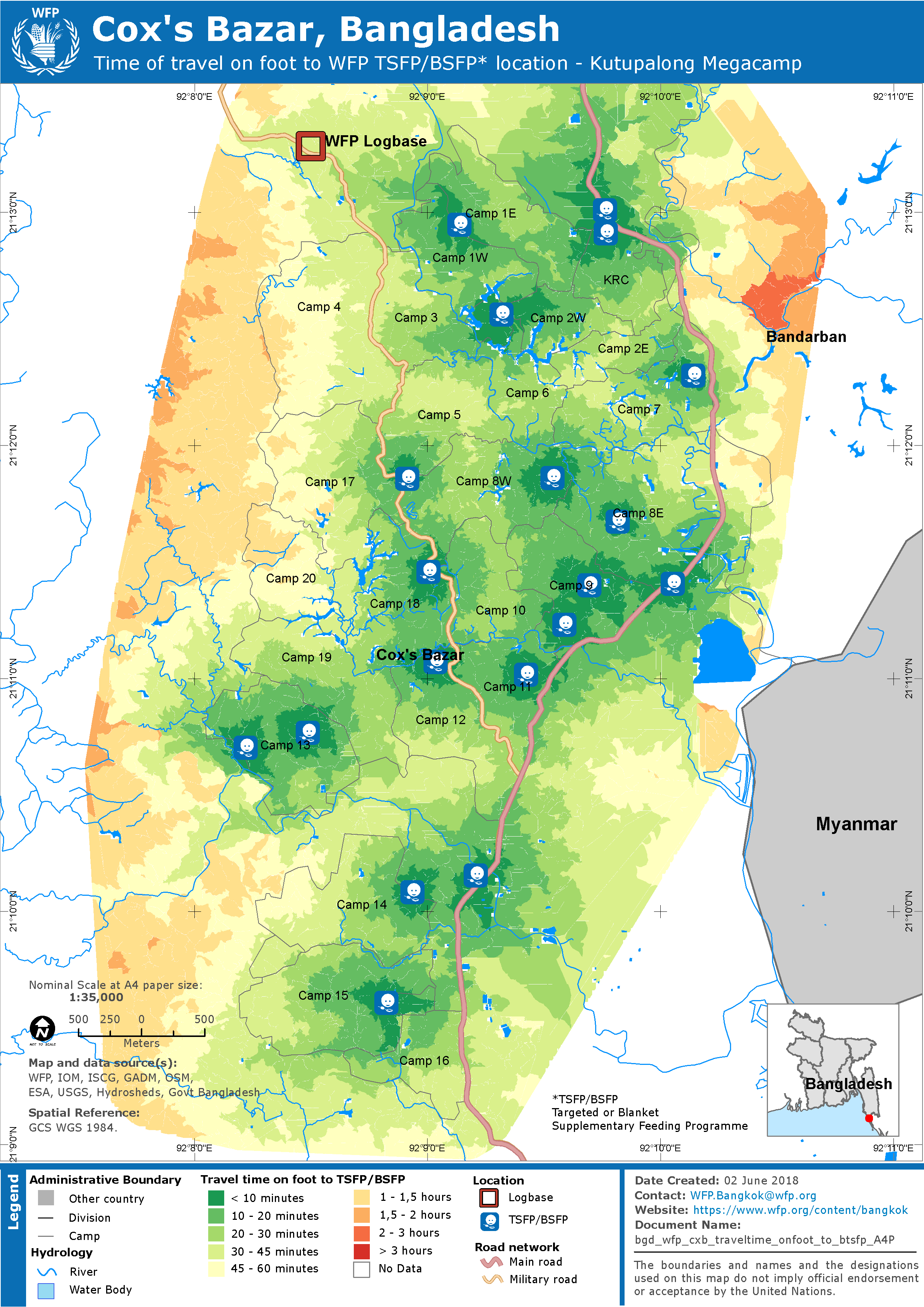
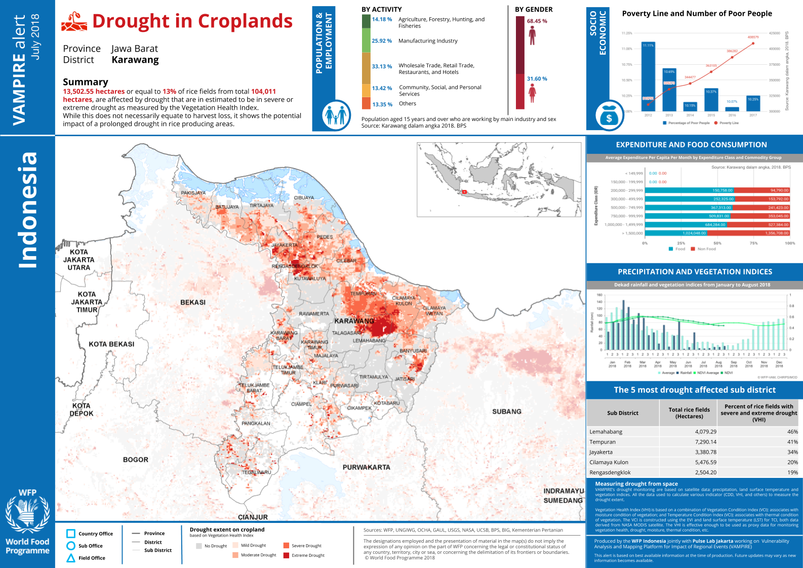
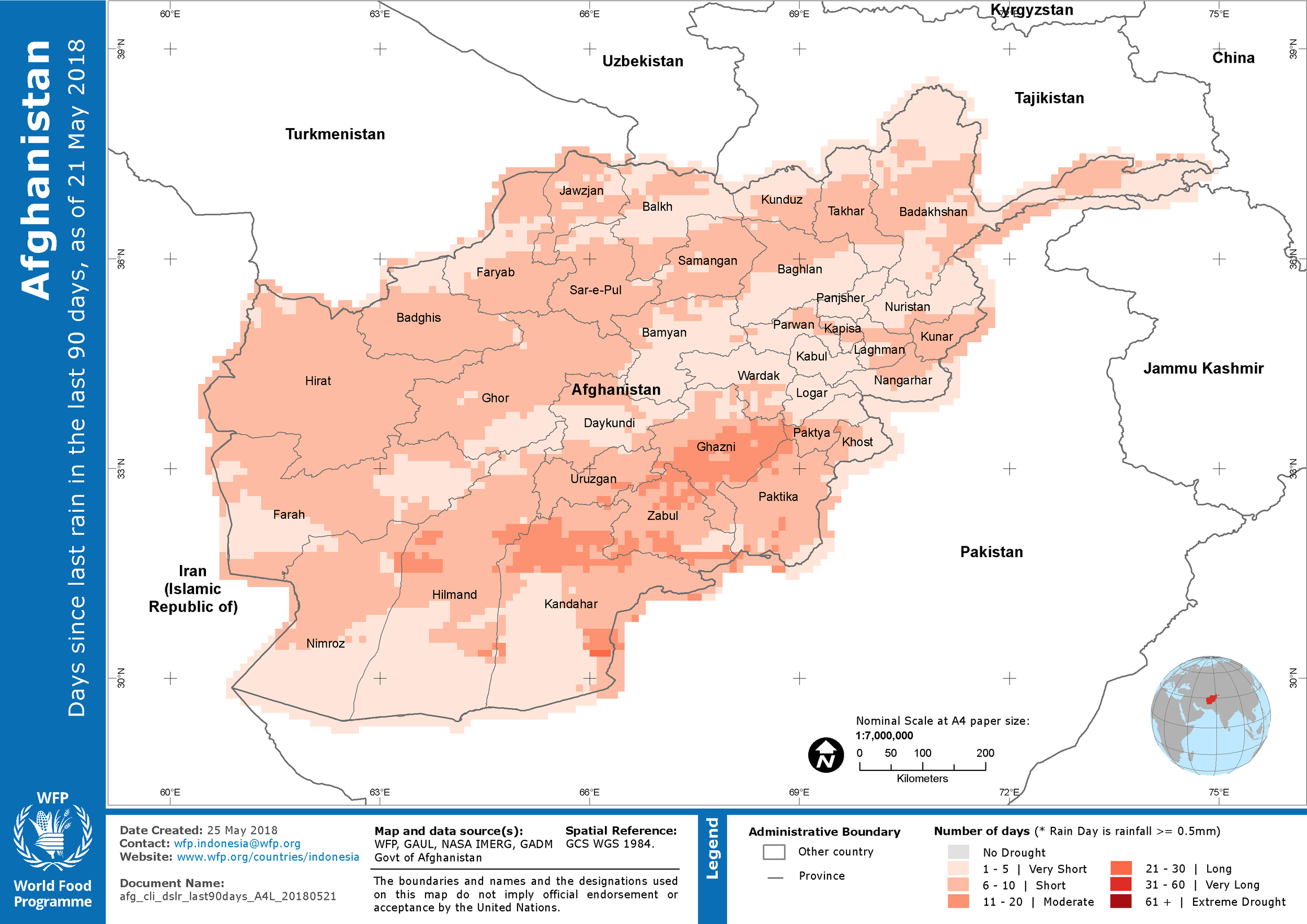
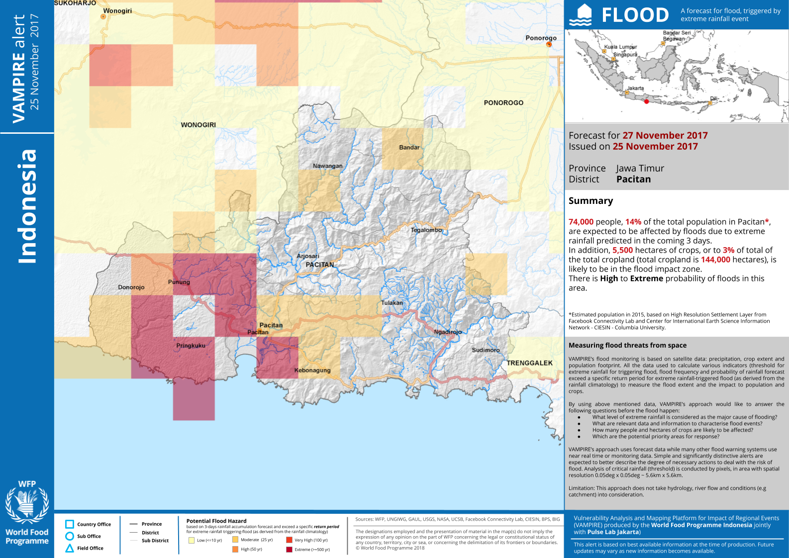
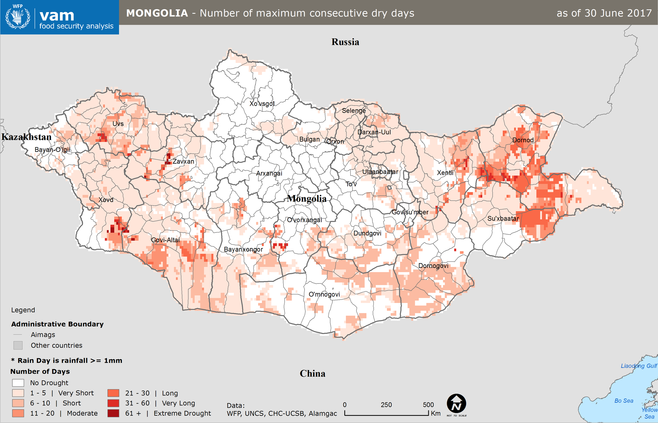
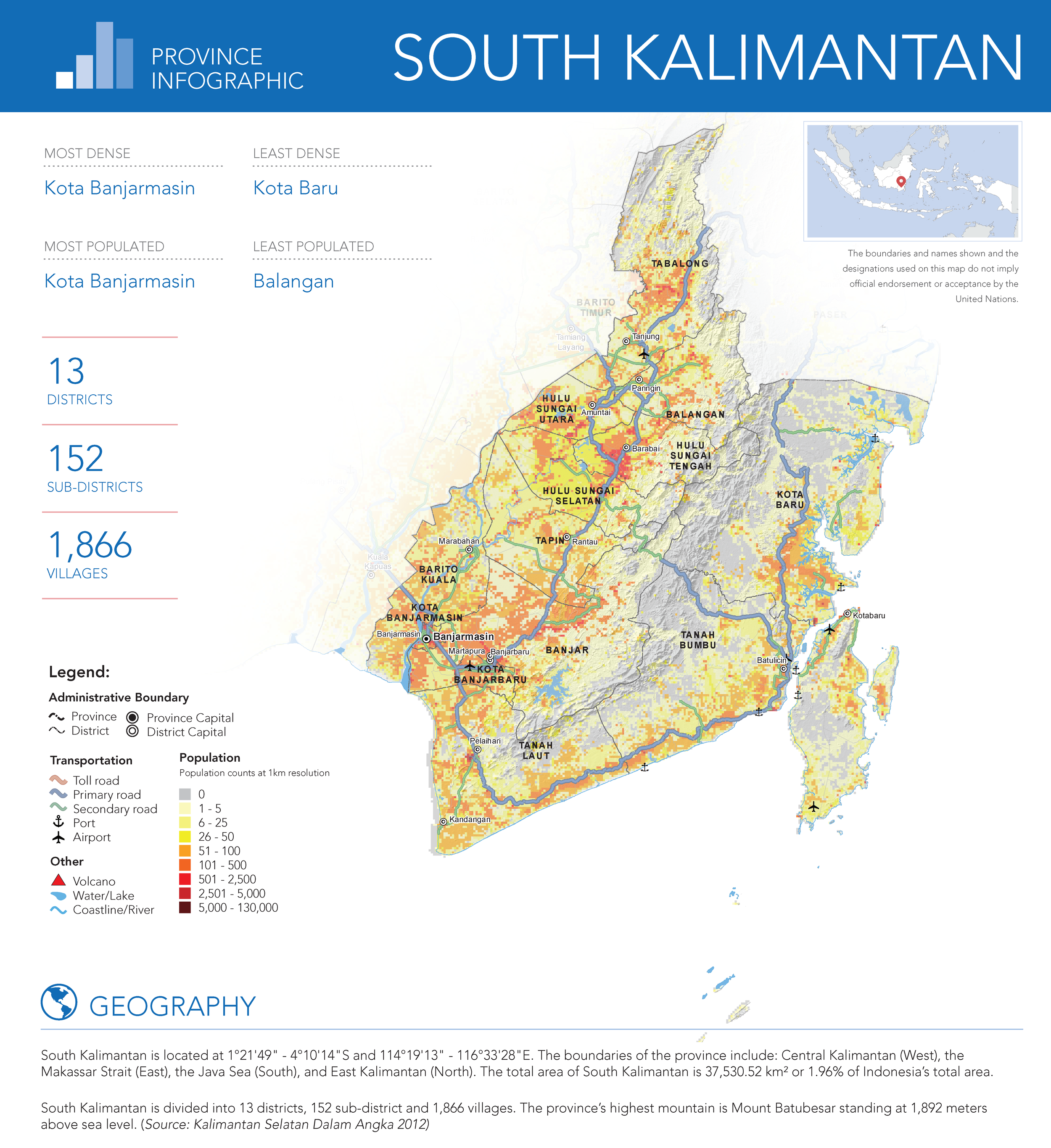
2018
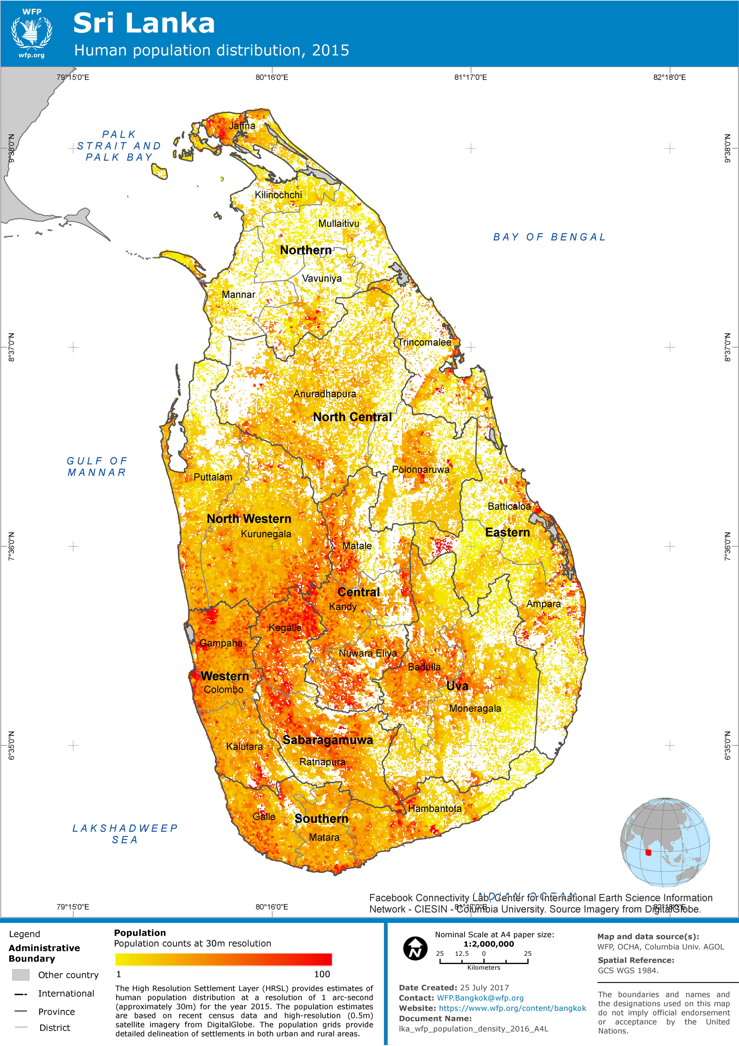
2017
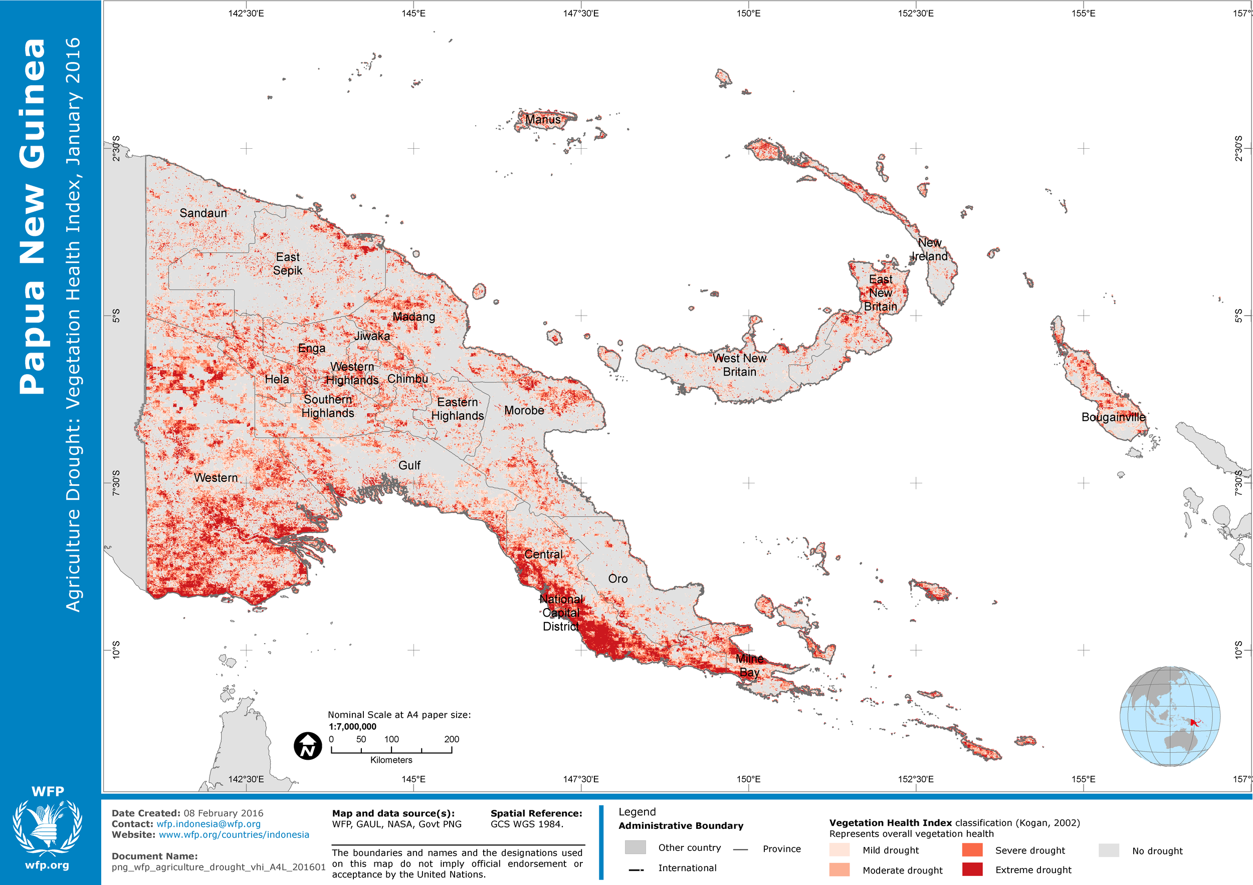
2016
2015
2014
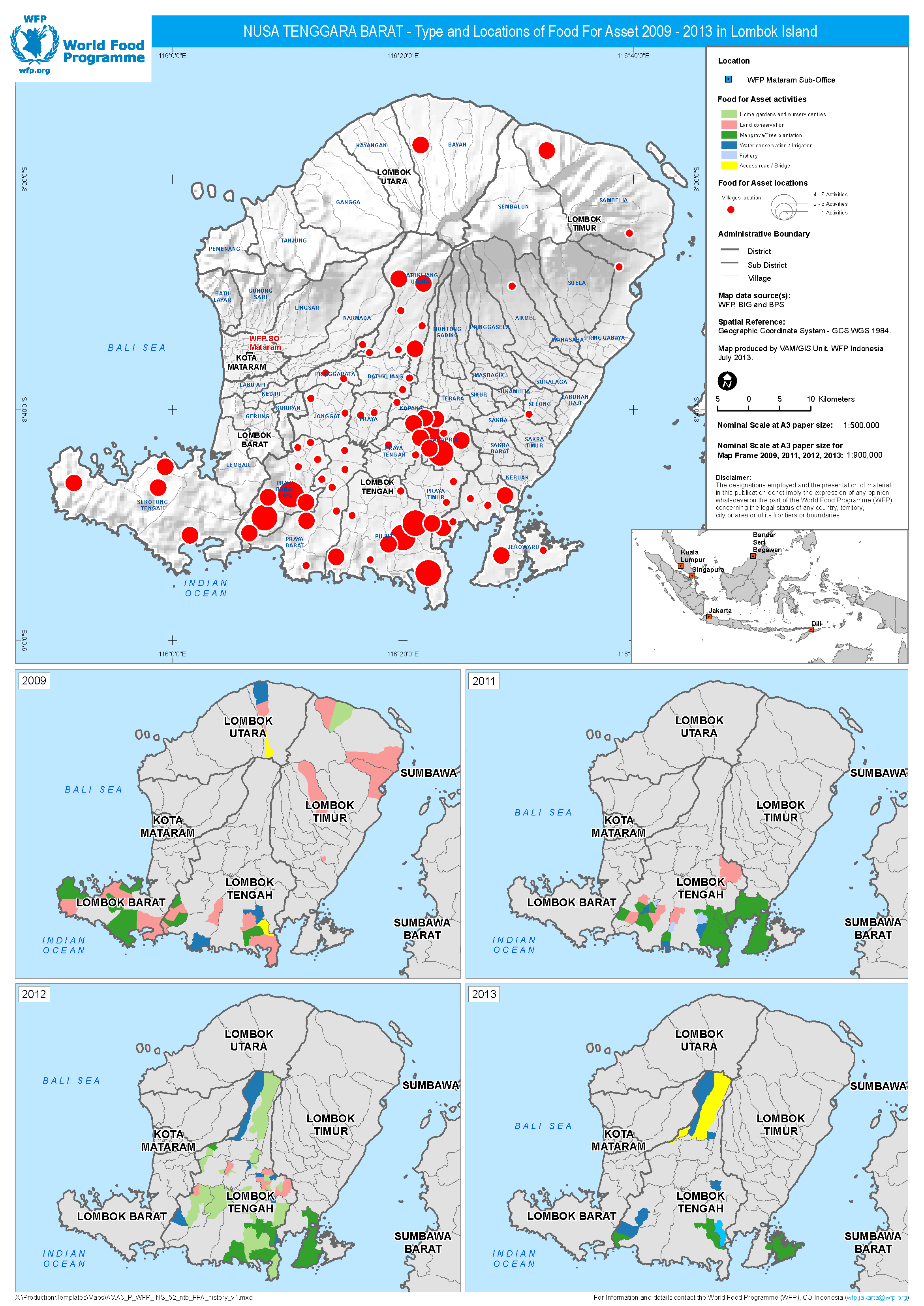
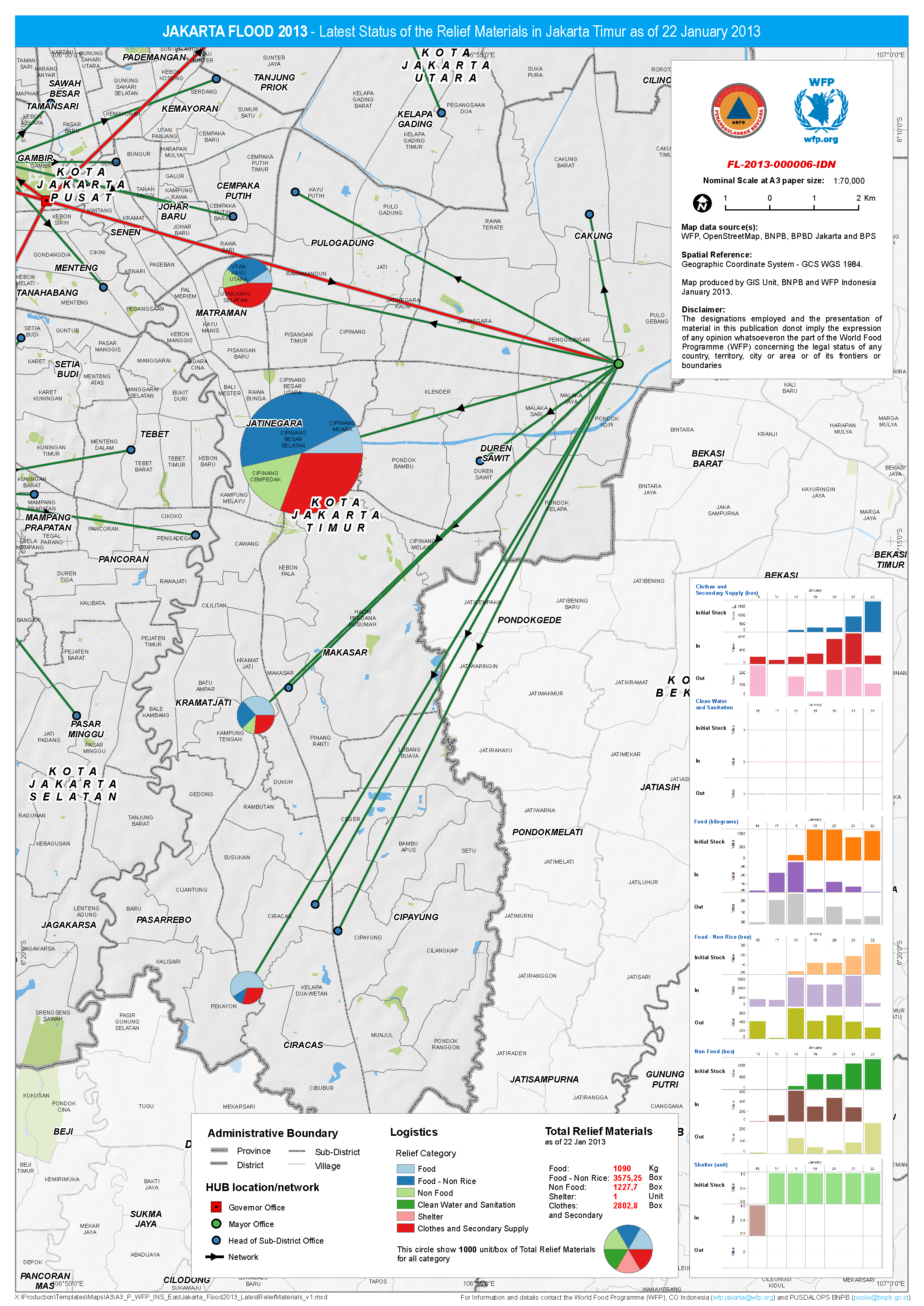
2013
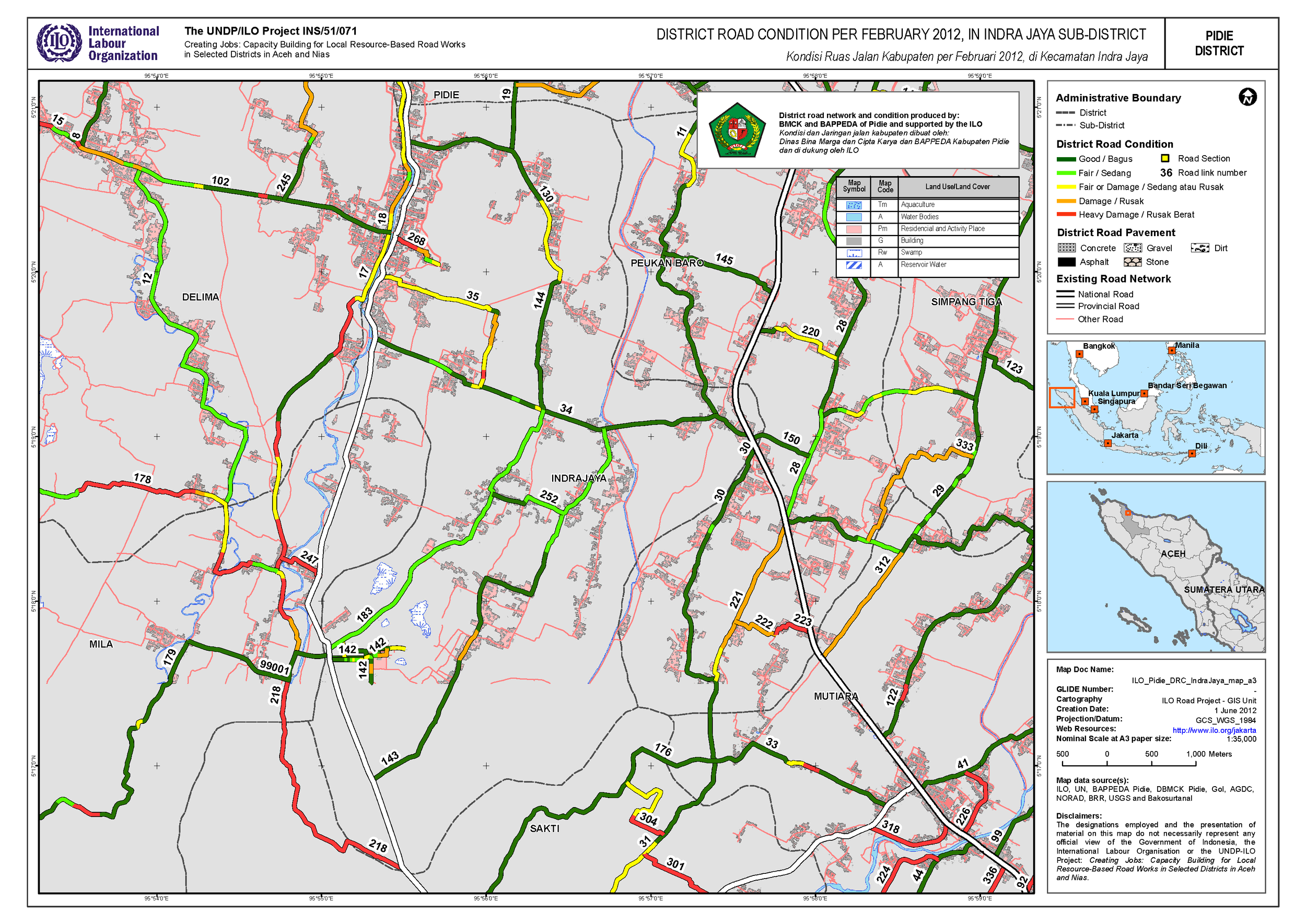
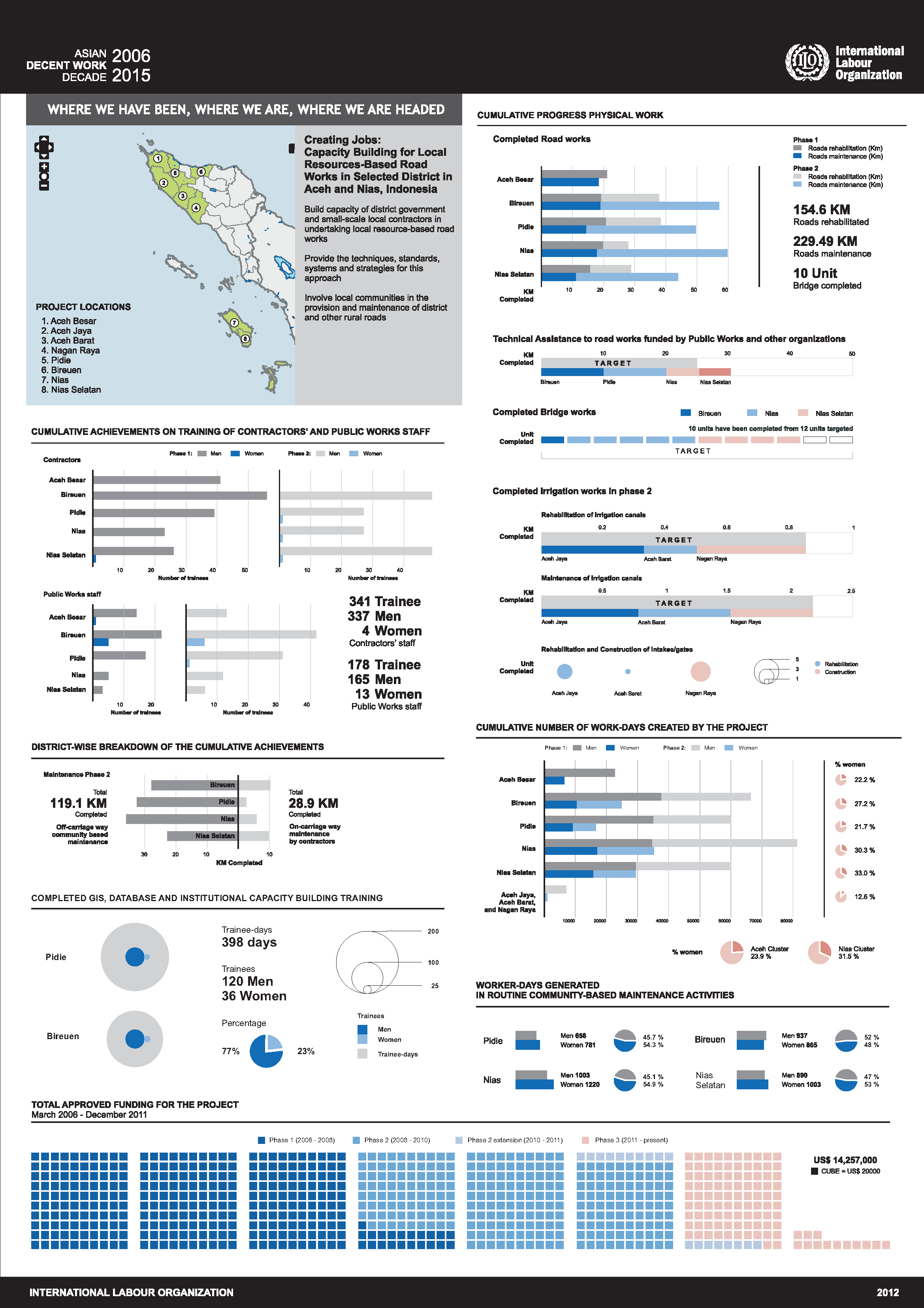
2012
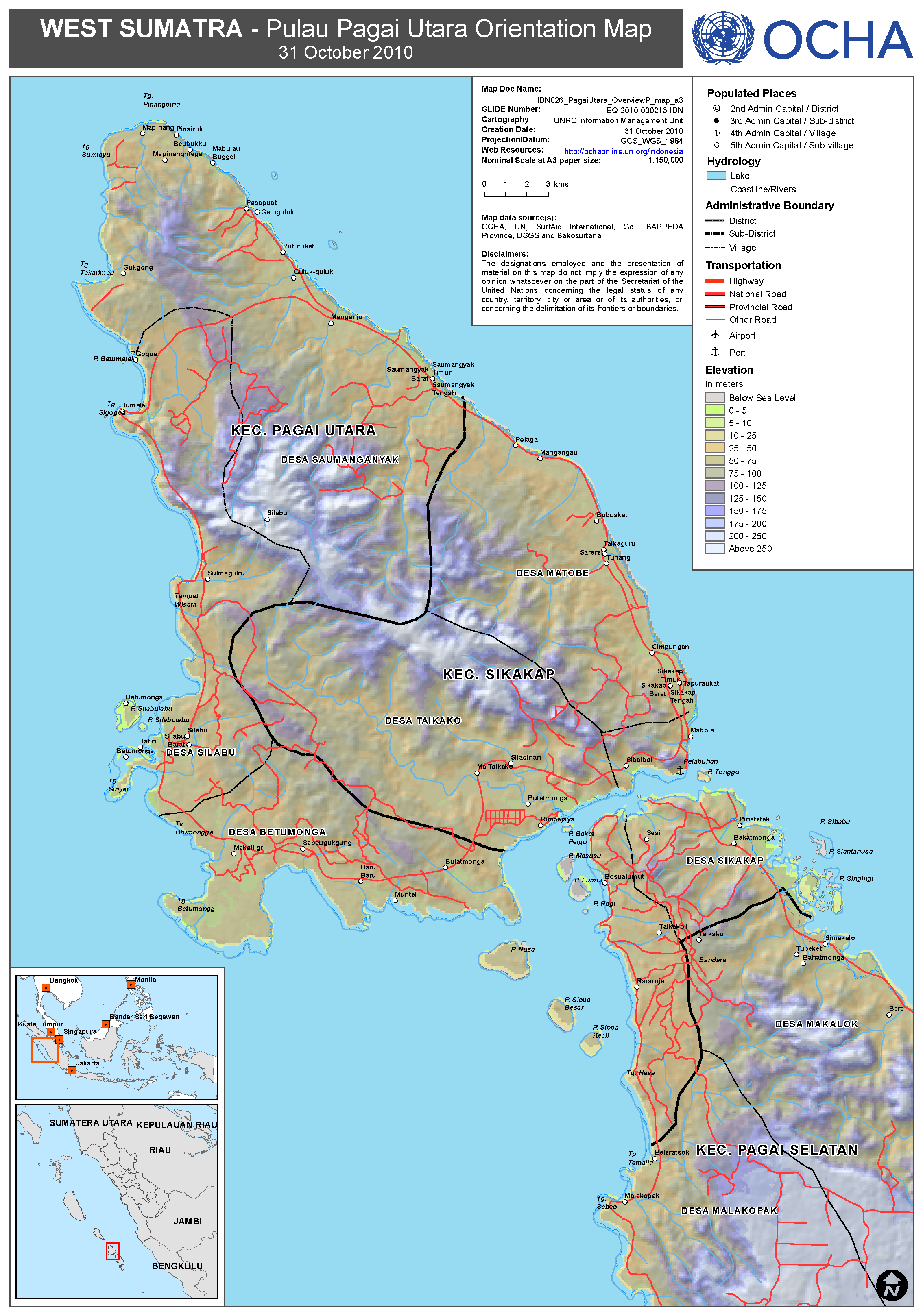
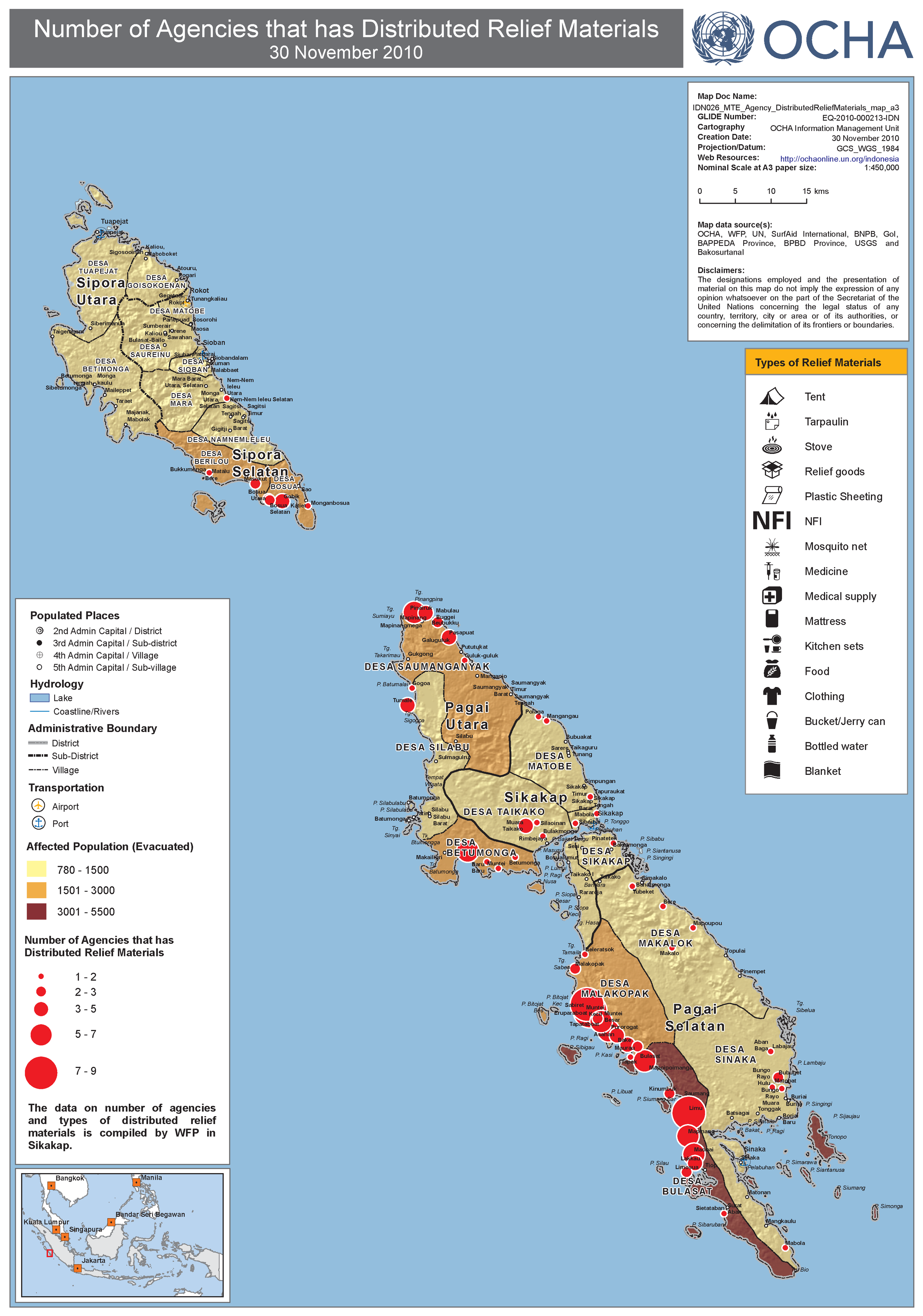
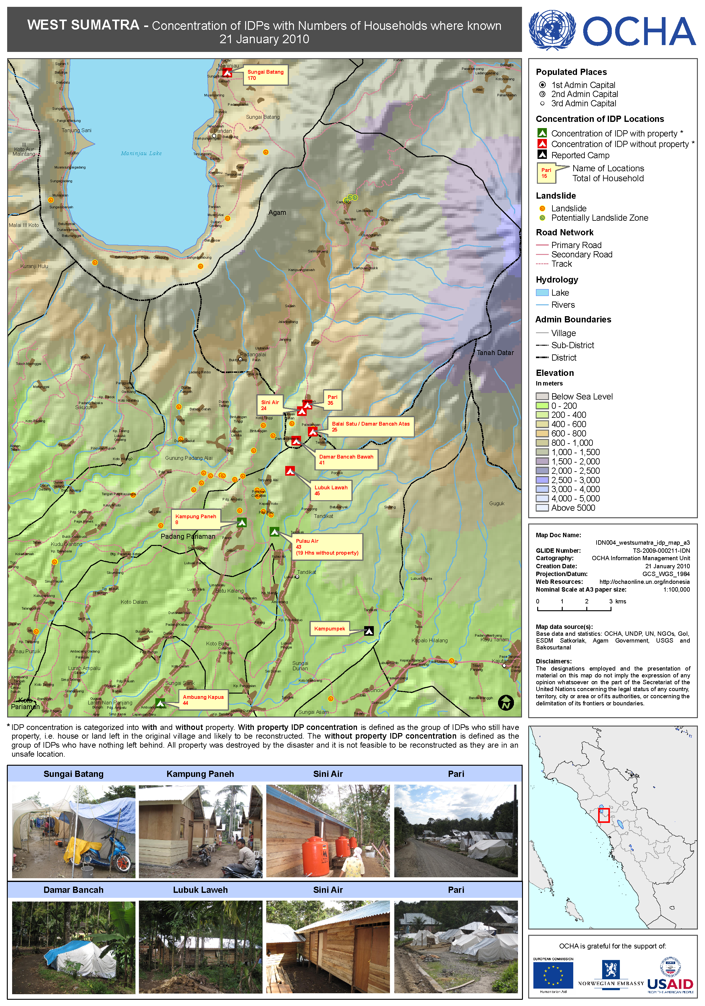
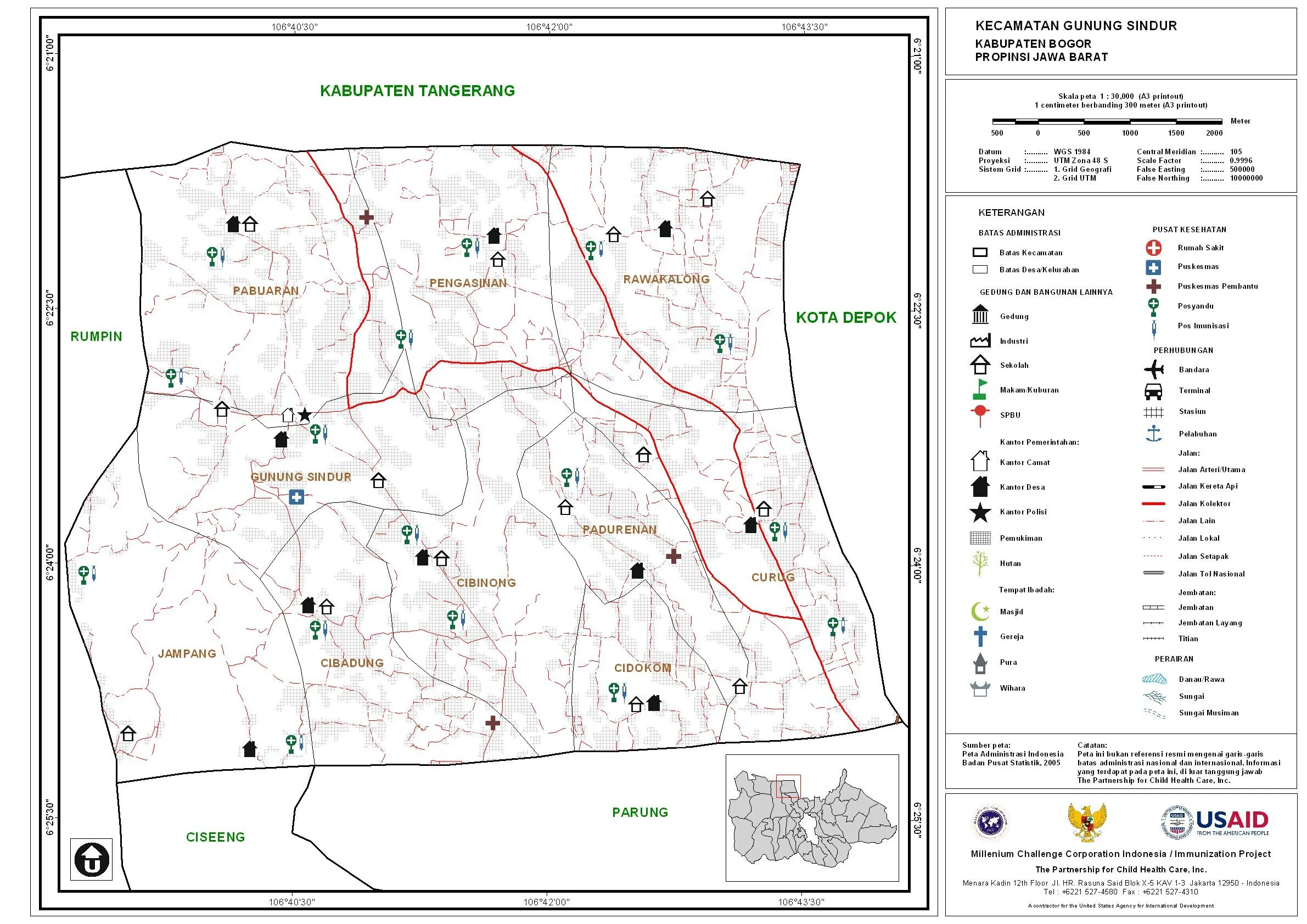
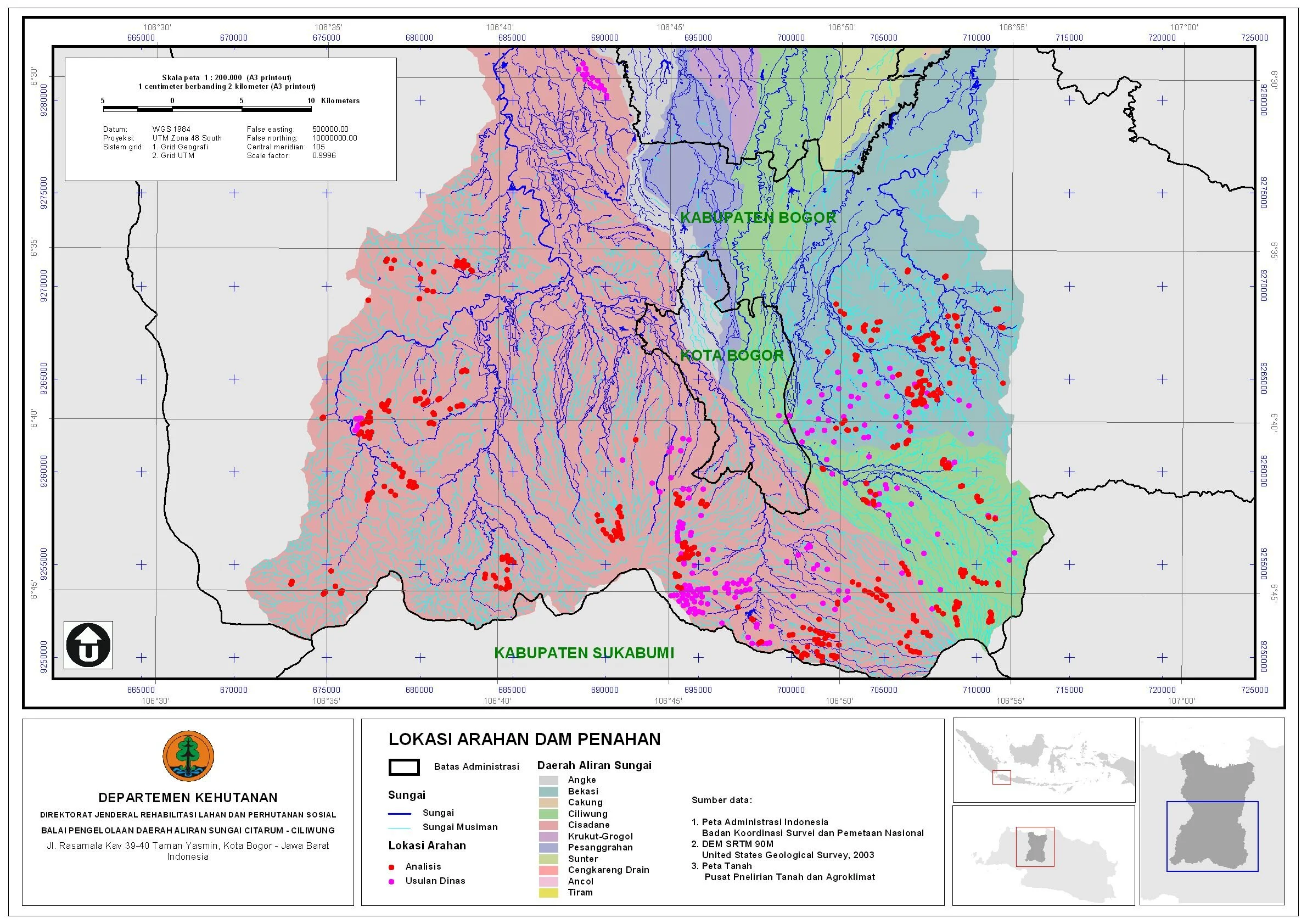
2010
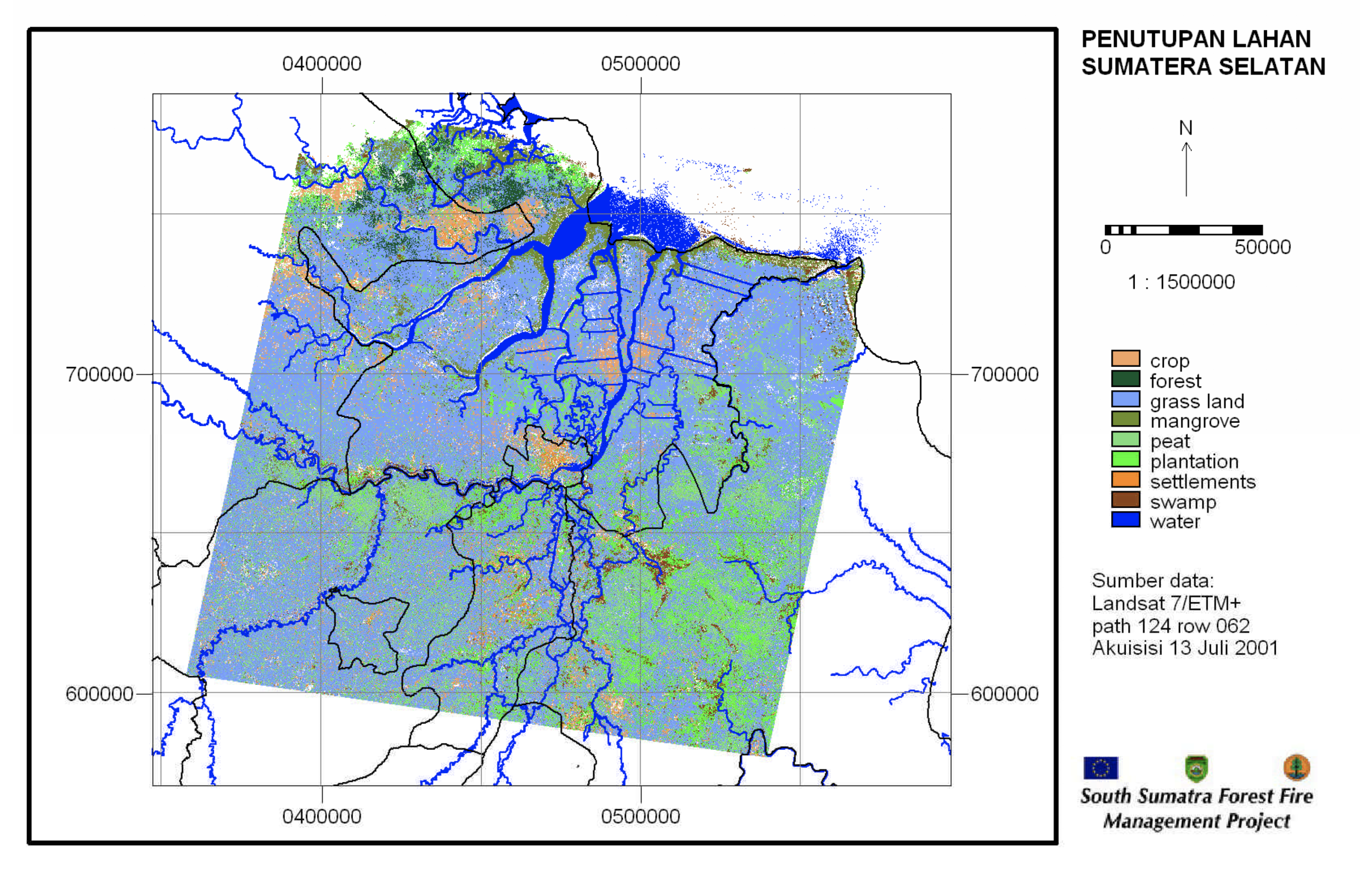
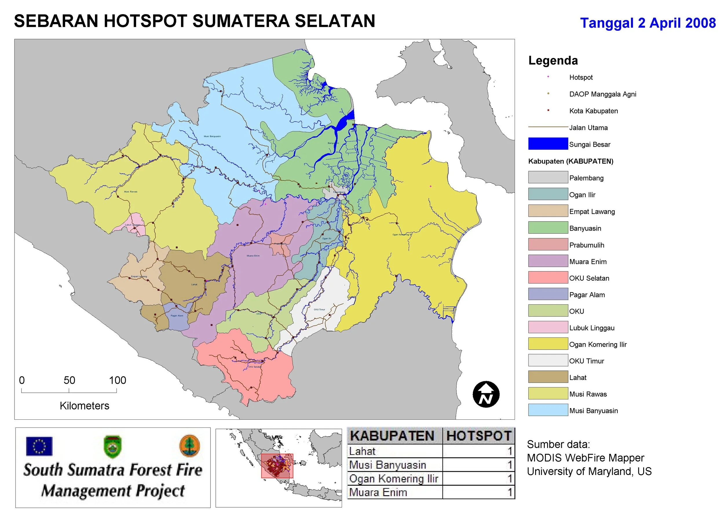
2009
2007
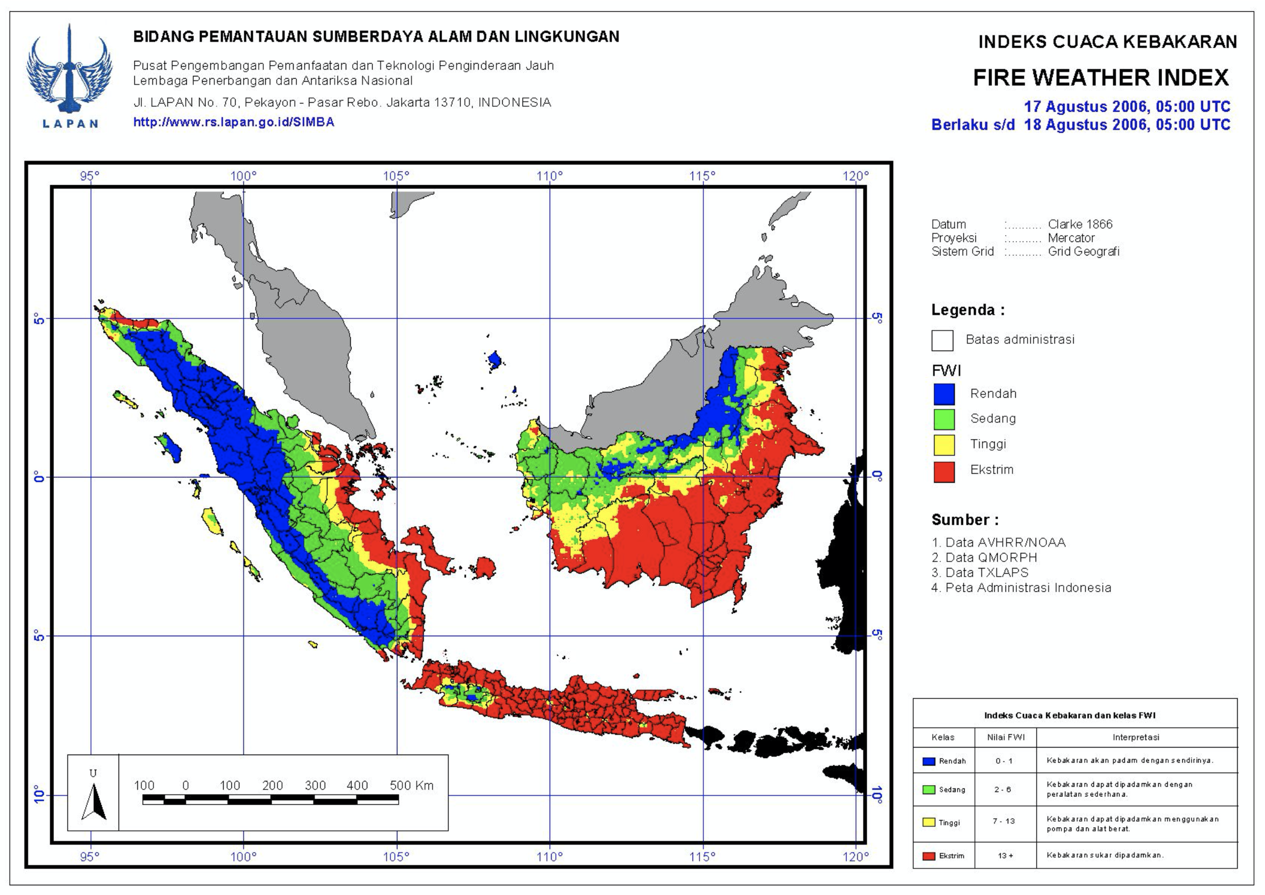
2006
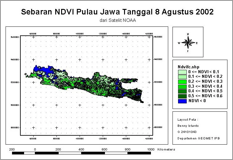
2004