Kriging and IDW interpolation in GEE
Remote Sensing
GIS
Climate
I have automatic weather station coordinates from BMKG, along with example data on precipitation accumulation for 1 - 10 Jan 2017 in csv format with column structure: Lon, Lat, Rainfall
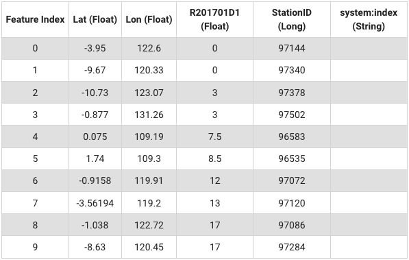
I have automatic weather station coordinates from BMKG, along with example data on precipitation accumulation for 1 - 10 Jan 2017 in csv format with column structure: Lon, Lat, Rainfall.
I uploaded this data into GEE assets, available as Feature Collection and accessible from this address: “users/bennyistanto/datasets/shp/rainfall_201701d1”
Is it possible to do Kriging and Inverse Distance Weighting (IDW) interpolation using Google Earth Engine?
Yes, it is. Follow below script.
Full link
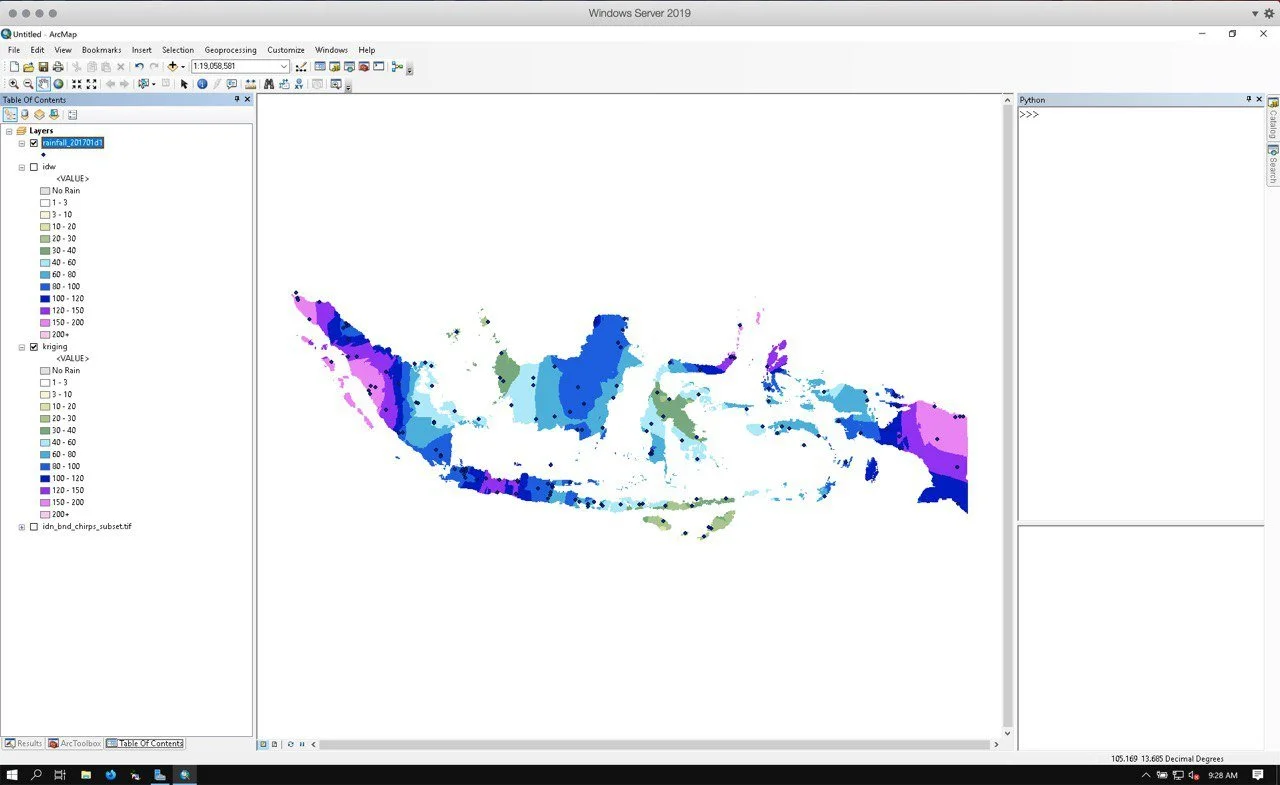
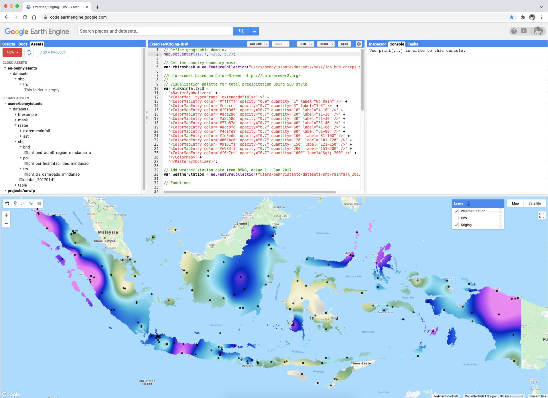
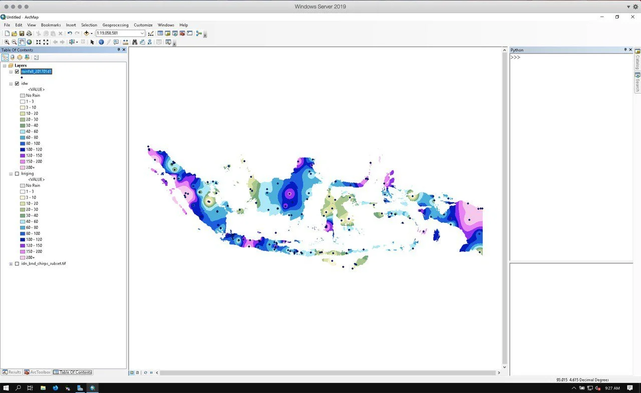
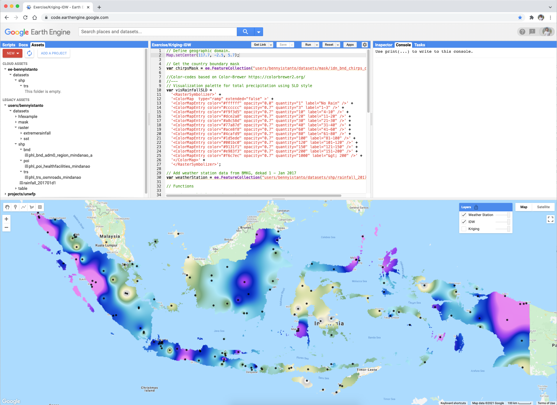
See below comparison from ArcGIS and GEE for both method. The pattern is slightly different due to GEE’s layer visualised using stretched colour while ArcGIS’s layer visualised using classified colour.