F/OSS for Forest Fire Monitoring
Remote sensing application for hotspot and forest fire monitoring using Free Open Source Software for Geospatial (FOSS4G)
Research and development of remote sensing applications for fire monitoring using Free and Open Source Software for Geospatial (FOSS4G) at the EU-funded South Sumatra Forest Fire Management Project (SSFFMP) in 2008.
Project Objectives
The Terms of Reference specified comprehensive evaluation and implementation of open-source geospatial software:
- Identify potential open-source applications for fire information systems
- Investigate and explore capabilities of identified applications
- Develop manuals for fire monitoring and land cover classification
- Compare strengths and weaknesses with proprietary solutions
- Train counterparts in application usage
Software Evaluation
Desktop GIS open-source applications evaluated for fire information system capabilities:
Assessed Applications: GRASS, Quantum GIS, uDig, gvSIG, SAGA, JUMP Family, ILWIS, KOSMO, MapWindow GIS
Implementation Criteria: 1. Operating System Support - UNIX, Linux, Windows, MacOS compatibility 2. Performance - Speed and efficiency 3. Data Format Support - Comprehensive format compatibility 4. Interoperability - OGC Specifications compliance
Selected Solutions
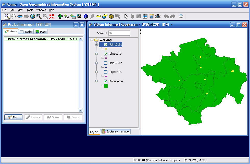
KOSMO - Selected for daily hotspot monitoring (vector data model applications)
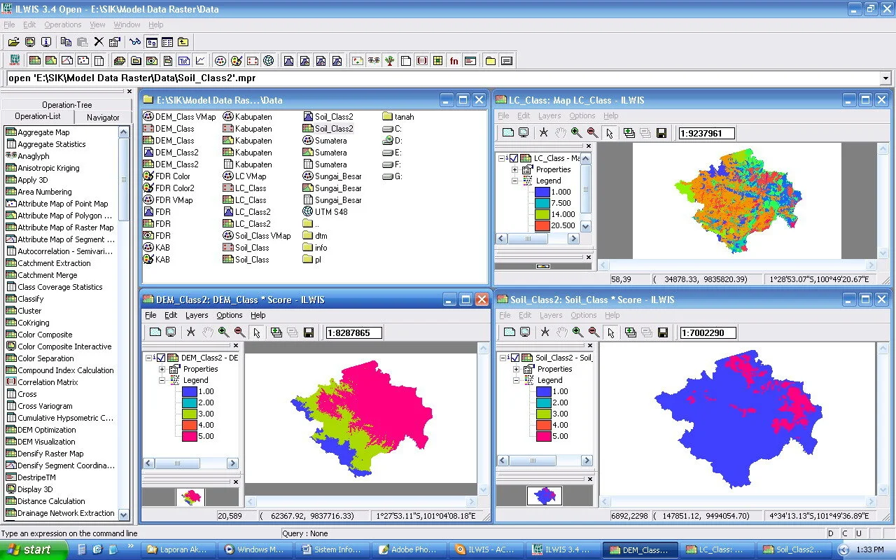
ILWIS - Selected for fire-prone area mapping (raster data model applications)
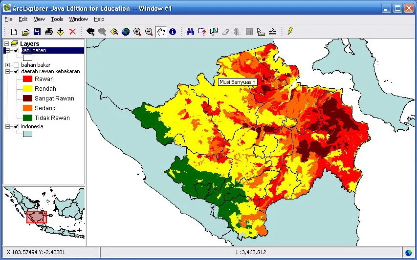
ArcExplorer Java Edition for Education (AEJEE) - Free GIS software (not open-source) used for supplementary tasks
The selection balanced functional requirements for daily monitoring operations and fire risk assessment with the practical considerations of software accessibility and intellectual property compliance.
Outcomes
The project demonstrated that open-source GIS software provides sufficient capability for daily hotspot monitoring and fire-prone area analysis. The research emphasized the importance of:
- Promoting open-source applications to address software piracy concerns
- Reducing barriers to legal software usage
- Enhancing human resource capacity in FOSS4G technologies
- Supporting sustainable fire information system development
Software Interface & Results